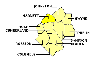
HARNETT COUNTY
Scroll down this page or click on specific site name to view features on the following Harnett County attractions/points of interest:
Averasboro Battlefield, Raven Rock State Park, William C. Lee Airborne Museum

Fast facts about Harnett County:
Created in 1855, the county is named for Cornelius Harnett, a Revolutionary War patriot, chief author of the “Halifax Resolves,” and delegate to the Continental Congress.
The county seat is Lillington, named for Colonel John Alexander Lillington, a Patriot officer at the Battle of Moores Creek. Other communities include Angier, Buies Creek, Coats, Dunn, and Erwin.
Harnett County’s land area is 595.01 square miles; the population in the 2010 census was 114,678.
It is worth noting that one of the last battles of the American Civil War took place in the vicinity of Averasboro in March, 1865.
South of Dunn
Averasboro Battlefield and Museum is located along the lines where one of the final battles of the American Civil War was fought. The largest battle waged in North Carolina occurred around Bentonville, March 19-21, 1865. The prelude to this crucial struggle, however, took place a few days earlier at Averasboro, a little to the south of Dunn, along the Harnett-Cumberland county line. Battlefield stops are located intermittently on a two mile stretch of NC 82 beginning about one mile north of the town of Godwin.
In the closing months of the Civil War, General Joseph E. Johnson, commanding the Confederate troops in North Carolina, attempted the near-impossible – halting the advance of two Federal armies commanded by Generals William T. Sherman and John Schofield. Johnson’s options were limited, but one opportunity afforded itself. Sherman had split his army into two wings, making it unclear whether his goal was to march on the state capitol or to Goldsboro, where badly-needed supplies awaited him. Johnson’s only hope was to beat back one of those two wings. To do so, he first needed to ascertain Sherman’s true objective, a need which resulted in the action at Averasboro. Although driven from the field after two days of fighting, the battle was a tactical victory for Confederates. Johnson determined the enemy’s true objective was Goldsboro, and the delay caused by the fighting widened the distance between the two wings of Sherman’s army, improving chances for a successful Confederate offensive.
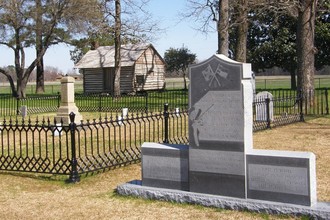
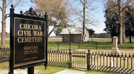
For visitors approaching the battlefield from Godwin, the first pull-off will be on the left, in front of two large state highway historical markers. The “Prelude to Averasboro” marker briefly explains the state of affairs in the closing months of the Civil War. The “Battle of Averasboro, Phase One” marker details the events of March 15, when Confederate pickets under Lt. General William J. Hardee skirmished with advance troops under Major General Henry W. Slocum. About one mile north of these markers is a second pull-off, also on the left, marking the Confederate battle line on the first day of the engagement. From here can be seen the Oak Grove plantation home, used during the fighting as a Federal field hospital. Small granite monuments here commemorate the sacrifices of both Union and Confederate soldiers who fought at Averasboro. A half-mile north, on the right, is the Chicora Confederate Cemetery. The “Battle of Averasboro, Phase Two” marker placed here explains the events of the second day of fighting, March 16. Several monuments dot the cemetery. At the back of the cemetery a slave cabin, moved from the nearby Lebanon plantation, has recently been reconstructed from original timbers.

Although the Averasboro Battle-field Commission has done much work in recent years to spruce up the appearance of these stops and to rebuild the slave cabin, the biggest improvement has been the addition of a museum. Con-verted from a private residence, the museum’s small size belies its scope. Among its many displays are several impressive miniature dioramas, archival photographs, weapons and uniforms, and numerous battlefield relics. One of the more touching items is a letter written by Jane Smith, a young woman who had lived at Oak Grove. In admiration of her Confederate defenders she wrote, “ . . . such an army of patriots fighting for their hearthstones is not to be conquered by such fiends incarnate as fill the ranks of Sherman’s army.” The letter was dated April 12, 1865, three days after Lee’s surrender at Appomattox. Museum hours are 10-4 Tuesday through Saturday and 1-4 Sunday. Admission is free, donations are accepted. Oak Grove and Lebanon plantation homes can be seen from the highway but are private residences.
Northwest of Lillington
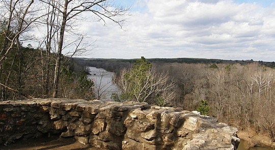
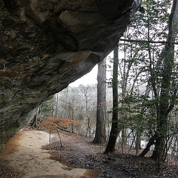
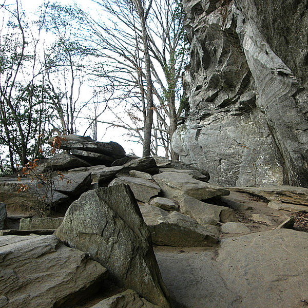
Raven Rock State Park is a 4,600-plus acre site near the geographic center of North Carolina that offers a variety of outdoor activities in a picturesque, tranquil setting. The park is situated along the Fall Line, where the hard rock of the North Carolina piedmont transitions into the softer rock of the coastal plains. The site’s most prominent feature, and that which gives the park its name, is the 150-foot cliff that runs more than a mile along the Cape Fear’s southern bank. Originally called Patterson’s Rock after one of the area’s early settlers, it was renamed Raven Rock in the mid-1800s, possibly because of the large numbers of black birds that perched atop the ledges.
Siouan and Tuscarora tribes once frequented the area. As European settlers began arriving in the Carolina backcountry in the mid-1700s, the rock soon became a natural landmark for travelers. For a time, the site was a part of the main transportation route between Raleigh and Fayetteville, and a ferry crossed the Cape Fear at this point. In 1854, locks and dams were built to facilitate river travel. A hurricane destroyed these navigational aids in 1859, however, and as railroad transportation was quickly supplanting river travel, the locks and dams were never replaced. When new roads opened, the ferry service ended as well, and Raven Rock became a recreational spot for local residents.
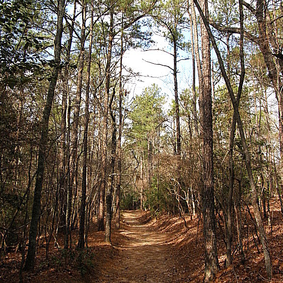
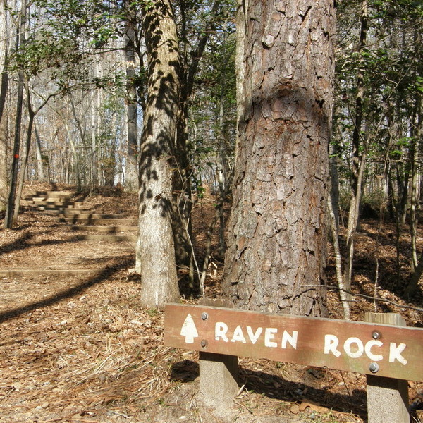
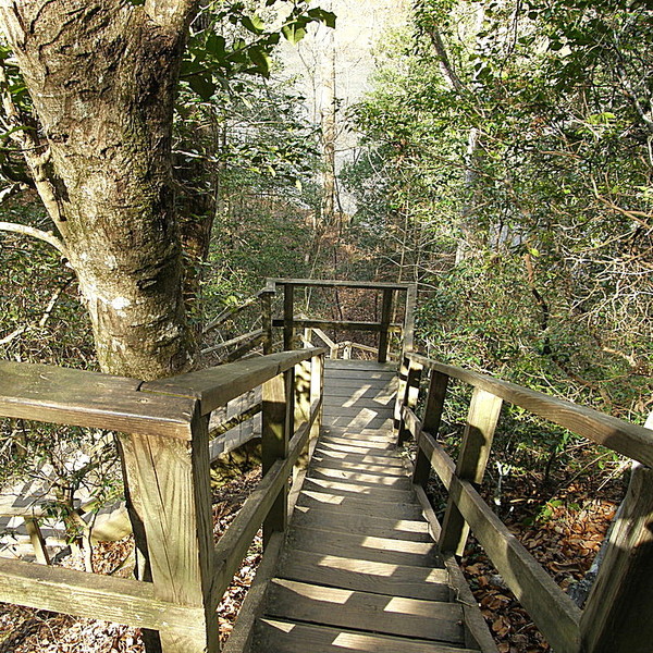
The NC General Assembly established the state park in 1969. In the beginning, the park contained less than 400 acres. In the intervening years, additional purchases have brought the park to its current size of 4,667 acres. The park offers a number of amenities, including three distinct camping areas (one specifically for canoeists) and a spacious picnic area with 27 tables and eight grills. The park’s major attraction is its hiking trails, all but one of which are designated as easy walks. Most popular is the loop trail that leads to Raven Rock. Even at midday, the leafy canopy of elms, maples, pines, and oaks filters the sunlight, so the trail is pleasantly shaded for virtually its entire length. The path itself is fairly level, but it ends with steep wooden steps – exactly 100 of them – leading down to the riverbank. Although the cliff parallels the river for over a mile, safety precautions restrict visitors to walking along a stretch of about 300 yards.
Less traveled is the 5-mile Campbell Creek Loop trial that leads to the photographic Lanier Falls. An even more secluded area of the park on the north side of the Cape Fear offers over seven miles of bridle paths, as well as a small picnic area. Anglers with a state fishing license will find such game fish as largemouth bass, bluegill, and catfish plentiful at the mouth of Campbell Creek and at a spot appropriately called Fish Traps. Canoeists can paddle a portion of the 56-mile Cape Fear Canoe Trail through the park and enjoy the challenge of negotiating the rapids of Lanier Falls and Fish Traps.

To get to Raven Rock State Park from Lillington or Sanford, take US 421 to State Road 1314 (Raven Rock Road). The park’s southern entrance is three miles north. To get to the bridle paths on the north side of the Cape Fear River, go north from Lillington on NC 210 to US 401. Drive north approximately 5 miles and go left on State Road 1412 (Christian Light Road). Go another 5 miles to State Road 1418 (River Road) and turn left. Raven Rock State Park is open every day except Christmas. The park opens daily at 8:00 AM, year-round; closing hours vary seasonally. Free admission; fees charged for camping. 910-893-4888
Dunn

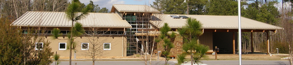
The William C. Lee Airborne Museum in Dunn, N. C., honors the acknowledged “Father of the Airborne,” native son William Carey Lee, who helped transform the vision of an allied airborne invasion of Europe into reality. The three-story house museum exhibits both personal effects and artifacts relating to Lee’s 27-year military career, as well as items specific to the development of the airborne.
William Lee was born March 12, 1895, one of six children. As a boy, he worked on tobacco and cotton farms, helped in his father’s hardware store, and participated in school sports. While attending N. C. State University, Lee enrolled in the ROTC program. In June, 1917, he enlisted in the U. S. Army, beginning a distinguished career in the military. In 1940, Lt. Colonel Lee was given command of the pioneering Parachute Test Platoon. Shortly after the country’s entry into World War II, Lee was promoted to Colonel on December 31, 1941. In March, 1942, the Airborne Command was constituted, with Lee as its commander, headquartered at Fort Bragg. Less than a month later, Lee was promoted to Brigadier General. In August, 1942, the Army’s first airborne divisions – the 82nd and the 101st – were formed; newly-promoted Major General Lee was placed in command of the latter. During a motivational speech to his paratroopers, Lee stated “this division has no history, but it has a rendezvous with destiny.” This destiny was realized during the Normandy invasion, but Major General Lee was not able to witness it firsthand. Following two heart attacks in the spring of 1944, Lee was shipped home. Recovering at his home in Dunn, with wife Dava at his side, Lee listened to accounts of the D-Day invasion on his radio. He was pleased to learn through reports a few days later that the paratroopers of the 101st, nicknamed the “Screaming Eagles,” honored their commander by yelling “Bill Lee,” rather than “Geronimo,” when they leapt from their aircraft.
The home in which Bill and Dava Lee lived was purchased by a private foundation in the mid-1980s. The brownstone house was restored at a cost of $500,000 in preparation for its use as a museum. The first floor parlor looks as it did when General Lee listened to accounts of the Normandy invasion on his radio. Throughout the house are numerous artifacts relating to the development of the airborne divisions and to their exploits during the war, including flight suits, jump suits, and a rare balloon jump suit from 1941 – these were quickly discarded because the material did not breathe, making them uncomfortable. Relics from the war include a collection of American, British, Russian, German, Italian, and Japanese rifles; an assortment of hand guns, including a German luger; and a rare folding bicycle, developed in England and manufactured in the U. S., and sent into battle with glider troops. One of the largest mementos is a U. S. flag, flown over Hitler’s famous “Eagle’s Nest” in the village of Berchtesgaden by members of the 506th and sent to General Lee with their gratitude as a memorial. Another interesting exhibit is an M-1 carbine rifle, autographed by inventor Marshall “Carbine” Williams, a fellow North Carolinian. This particular rifle was fired in salute to its inventor at his graveside service in 1975. Museum hours are 8:30-4:30 Monday through Friday and 11-4 Saturday. Admission is free. 919-892-1947
Harnett County is bordered CHATHAM (Region Four), CUMBERLAND, JOHNSTON, LEE (Region Four), MOORE (Region Seven), SAMPSON, and WAKE (Region Four).
Return to REGION FIVE HOME PAGE.
Return to GEOGRAPHIC REGIONS HOME PAGE.