TYRRELL COUNTY
Scroll down this page or click on specific site name to view features on the following Tyrrell County attractions/points of interest:
Pettigrew State Park, Pocosin Lakes National Wildlife Refuge
Fast facts about Tyrrell County:
Created in 1729, the county is named for John Tyrrell, one of the Lords Proprietors.
The county seat is Columbia. Other communities include Fort Landing, Frying Pan Landing, Gum Neck, Kilkenny, Newfoundland, and Woodley.
Tyrrell County’s land area is 378.39 square miles; the population in the 2010 census was 4,407.
It is worth noting that the Pocosin Lakes National Wildlife Refuge, encompassing 110,000 acres, is centered in Columbia. Folks in eastern North Carolina pronounce the county name "TEAR-el."
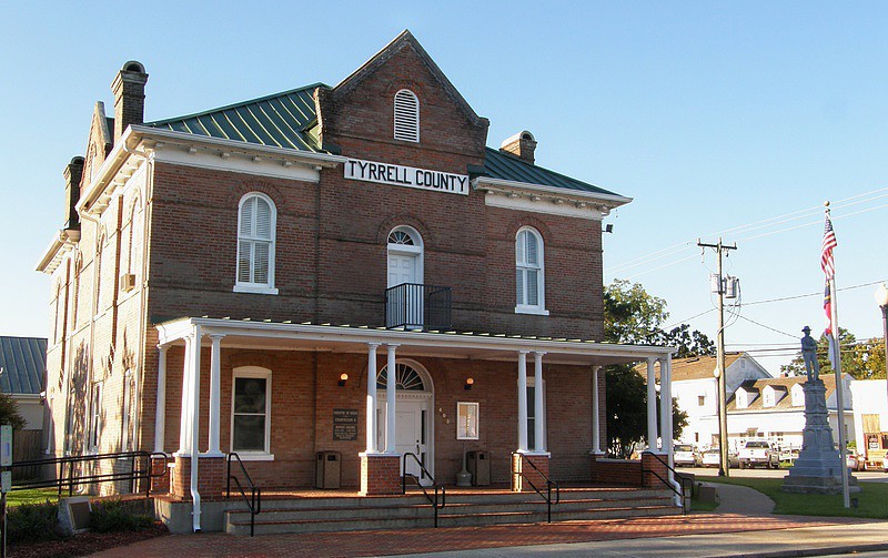
Below: Tyrrell County Courthouse, Columbia
South of Creswell
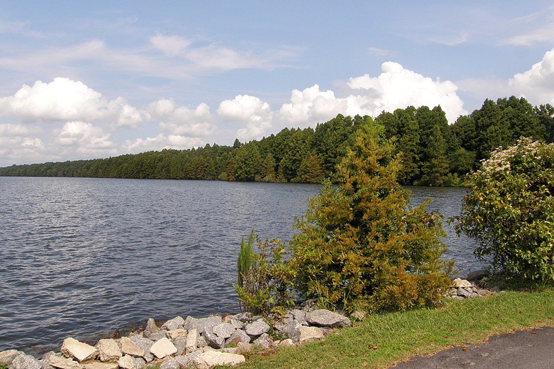
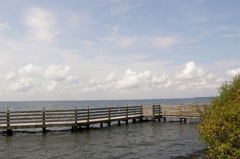
Pettigrew State Park, straddling Tyrrell and Washington counties, covers nearly 17,500 acres, including 16,600 of water. Lake Phelps is the second largest freshwater lake in the state and is one of the many Carolina “bay lakes,” so-called because of the abundance of bay trees growing nearby. Fed only by precipitation and springs, the average depth of Lake Phelps is four feet, and its maximum depth is only eight feet. With 25 square miles of water surface, the obvious activities are fishing and boating. Those enjoying the former are likely to catch largemouth bass and bluegill in the spring and fall, yellow perch in the summer. Steady winds make Lake Phelps ideal for sailboating, but rowboats, canoes, and kayaks are popular as well. Boat ramps are located near the park’s information center. A family campground, picnic grounds, and rest rooms are also located here. Several easy hiking trails are in the offing. The Bee Tree Canal walk leads to an observation platform with a good view of Lake Phelps. The Moccasin Canal Trail features a 300-foot boardwalk passing through a cypress forest, with other parts of the trail winding through stands of sycamore, gum, poplar, and bald cypress.
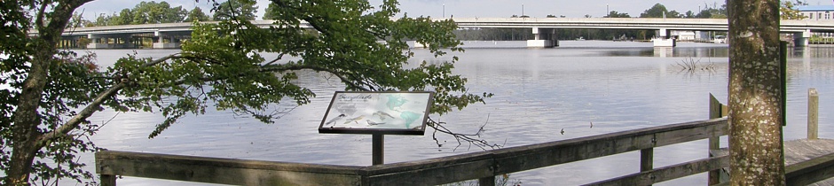
Columbia
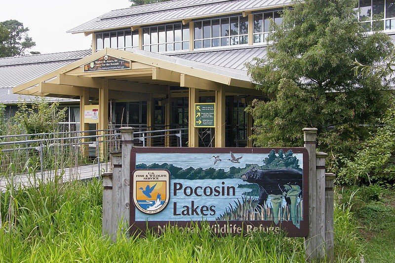
Pocosin Lakes National Wildlife Refuge [PLNWR] was established in 1990 and covers 110,000-plus acres in Tyrrell, Washington, and Hyde counties. The Walter B. Jones, Sr. Center for the Sounds, located off US highway 64 in Columbia, serves as the main visitor center for the Refuge. The Center includes a video and interpretive exhibits. Behind the Center is the Scuppernong River Interpretive Boardwalk, a ¾-mile loop that weaves its way through a cypress swamp. The boardwalk was one of the first projects undertaken and completed by The Partnership for the Sounds, in conjunction with the PLNWR, The Conservation Fund, the Town of Columbia, and Tyrrell County. Another paved walkway passes under the highway bridge crossing the Scuppernong River and leads to downtown Columbia. 252-796-3004

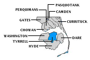
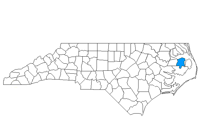
Tyrrell County is bordered by DARE, HYDE, and WASHINGTON counties.
Return to REGION ONE HOME PAGE.
Return to GEOGRAPHIC REGIONS HOME PAGE.