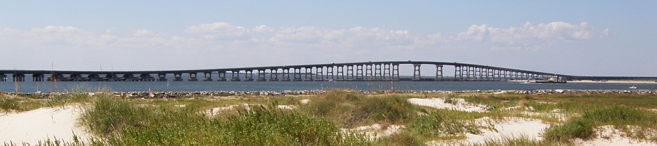
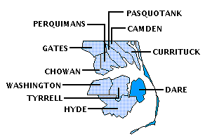
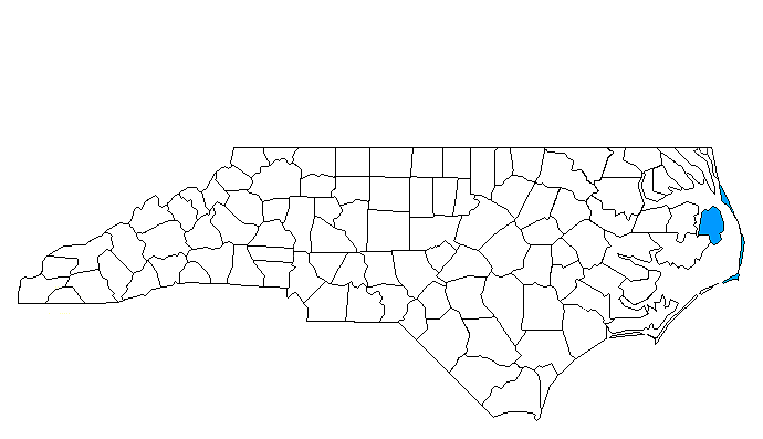
DARE COUNTY
Scroll down this page or click on specific site name to view features on the following Dare County attractions/points of interest:
Alligator River National Wildlife Refuge, Bodie Island Lighthouse, Cape Hatteras National Seashore, Chicamacomico Life-Saving Station Historic Site, Elizabethan Gardens, Fort Raleigh National Monument, Frisco Native American Museum, Graveyard of the Atlantic Museum, Hatteras Lighthouse, Island Farm, Jennette's Pier, Jockey's Ridge State Park, Monument to a Century of Flight, Nags Head Woods Preserve, National Wildlife Refuges Gateway Visitor Center, North Carolina Aquarium at Roanoke Island, Pea Island African American Heritage Center Museum, Pea Island National Wildlife Refuge, Outer Banks History Center, Roanoke Island Festival Park, Roanoke Island Maritime Museum, Roanoke Marshes Lighthouse, Wright Brothers National Memorial
Fast facts about Dare County:
Created in 1870, the county is named for Virginia Dare, the first child born of English parents in America.
The county seat is Manteo, named for a Native American Indian who befriended the first English explorers. Other communities include Duck, Kill Devil Hills, Kitty Hawk, Nags Head, Sanderling, Southern Shores, and Wanchese.
Dare County’s land area is 383.58 square miles; the population in the 2010 census was 33,920.
It is worth noting that the famous “Lost Colony,” England’s first attempt to establish a permanent settlement in the New World, was located on Roanoke Island in Dare County; the historic first flights of Orville and Wilbur Wright took place on the sandy dunes of Dare County’s outer banks on December 17, 1903.
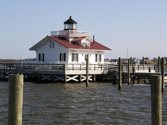
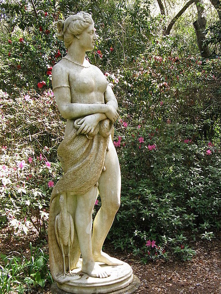
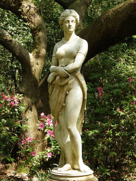
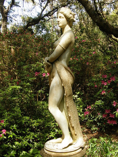
Below: The Roanoke Marshes Lighthouse at Manteo
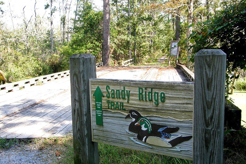
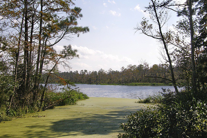
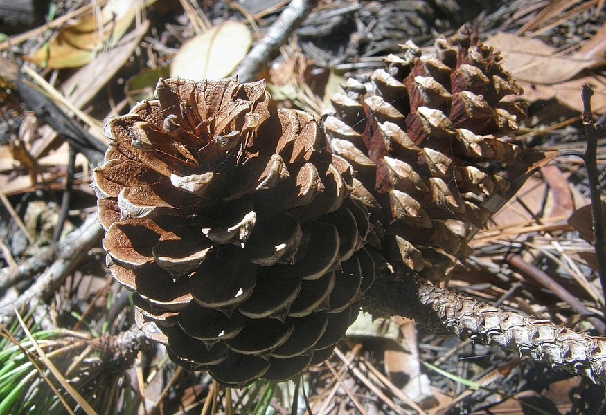
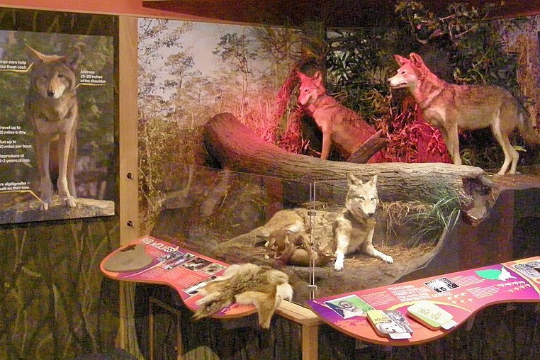
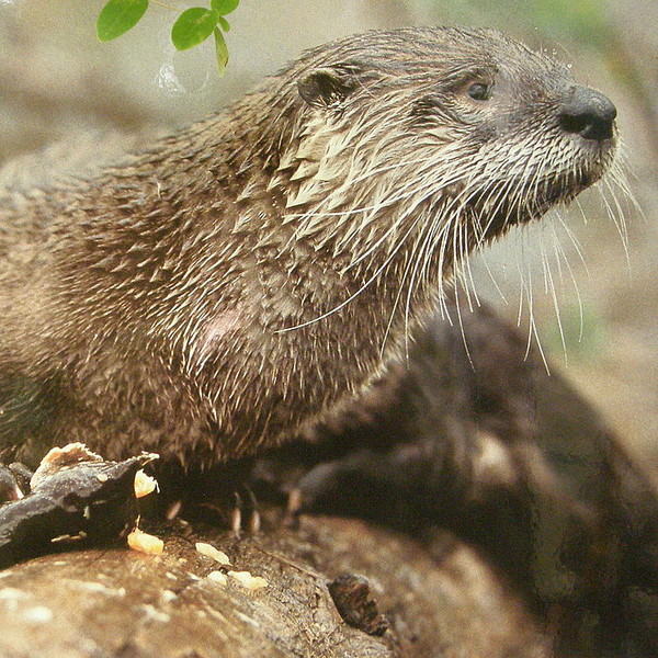
Alligator River National Wildlife Refuge [ARNWR], established in 1984, encompasses 152,000 acres of upland swamp covering most of the Dare County mainland. Habitats include pocosins, fresh water and brackish water marshes, and hardwood and cedar swamps, along with managed farming areas. The Alligator River itself forms the western boundary of the Refuge and separates Dare and Tyrrell counties. US highway 64 runs east-west through the northern section of the Refuge, while US 264 runs north-south down the eastern edge into Hyde County. The Creef Cut and Sandy Ridge Wildlife Trails are both easily accessible from US 64 at the northern end and provide good opportunities for spotting such inhabitants as black bear, deer, and river otters, plus a variety of birds (possibly as many as 250 species make their home in the Refuge), reptiles, and amphibians. The wildlife is generally most active at dawn and dusk. During winter months, ARNWR is an especially good place to view large populations of migratory birds and waterfowl.
The Sandy Ridge Trail, a half mile trail one-way, is handicapped-accessible and features a 2,300-foot boardwalk and an overlook of Milltail Creek. Four paddle trails originate at the end of Buffalo City Road, including an 8-mile round-tripper that goes west to the Alligator River, a 4-mile trail to and from Sawyer Lake, and a l.5 mile loop trail. Kayaking or canoing affords an excellent way to explore the Refuge.
The Refuge is noted for its resurgent red wolf population. A small number of wolves were released in the Refuge in 1987 and their numbers have been growing steadily since then; despite the program's success, however, red wolves remain on the list of endangered species. Red wolves are larger than coyotes but smaller than gray wolves, and, while the reddish-brown canines may occasionally be heard in the distance, they are rarely seen. ARNWR is open daily from one-half hour before sunrise to one-half hour after sunset. 252-473-1131
South of Nags Head
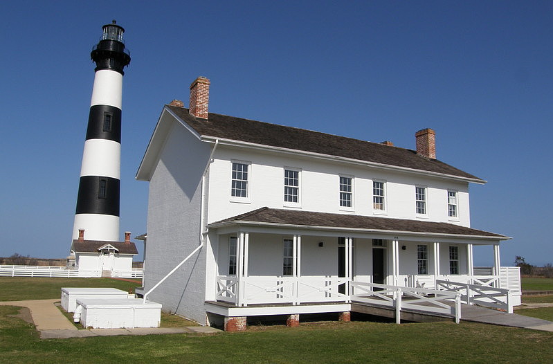
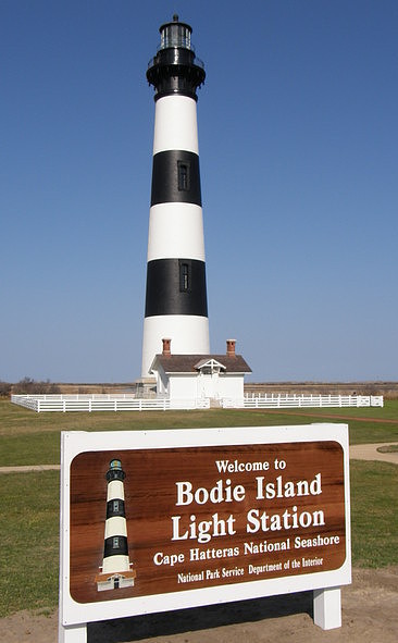
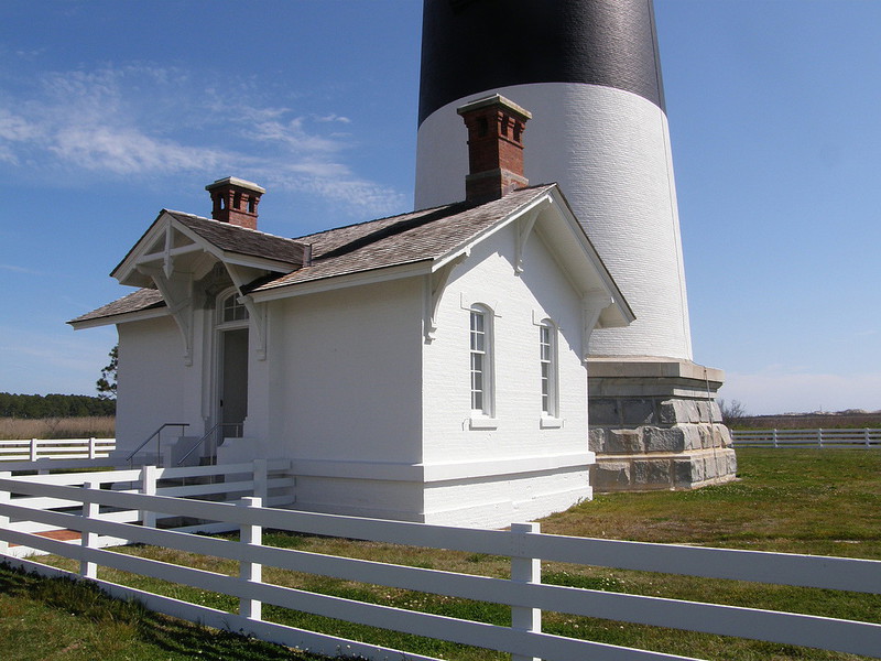
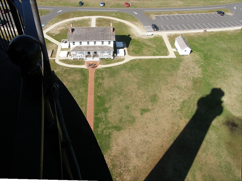
Bodie Island Lighthouse is more than 140 years old, but the tall, slender sentinel on Bodie Island has never looked better! The lighthouse’s recent multi-year, multi-million dollar facelift was worth every penny. Not only does this guardian of the sea now look every bit as grand as when first built in 1872, but now, for the first time ever, the tower is open to the general public for climbing! April 19, 2013 was a historic day for the black-and-white, horizontally-striped beacon that has faithfully served as a navigational aid for mariners along North Carolina’s Outer Banks. Over the years, the steps of the Bodie Island lighthouse have been climbed many times by its various caretakers: first, by the lighthouse keepers themselves, actively engaged in its operation; later, by national park rangers, entrusted with its safekeeping; and, most recently, by those employed to refurbish
the iconic tower and make it structurally sound. But at 9:00 AM on Friday, April 19, 2013 members of the general public were able to climb these steps for the first time. Buffeting winds prevented the first tour group from actually going out onto the balcony – that distinction went to the second group to make the ascent – but from this point forward, the Bodie Island Lighthouse, like those at Cape Hatteras and Currituck Beach, will be open seasonally for climbing.
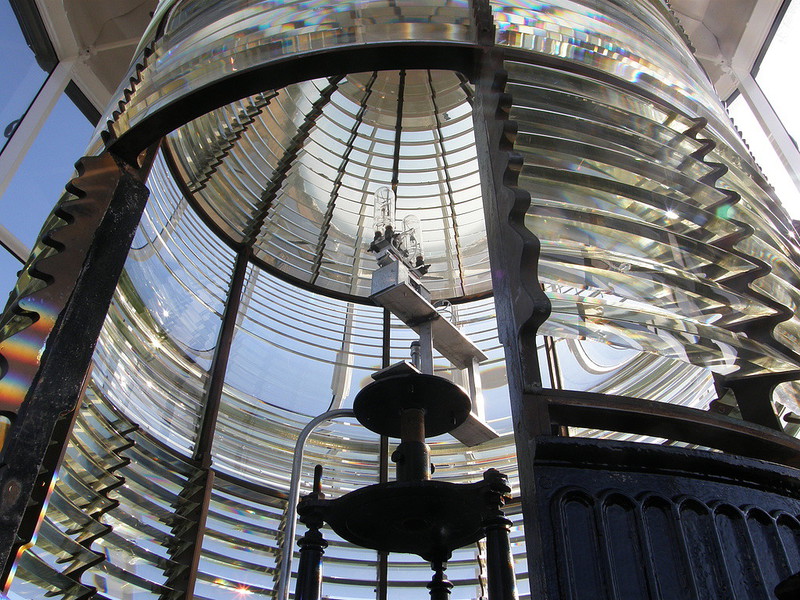
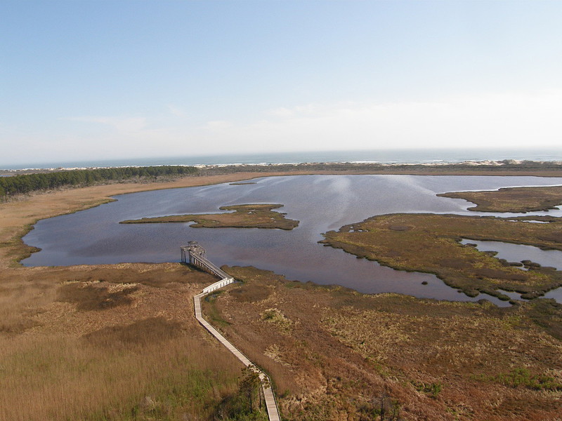
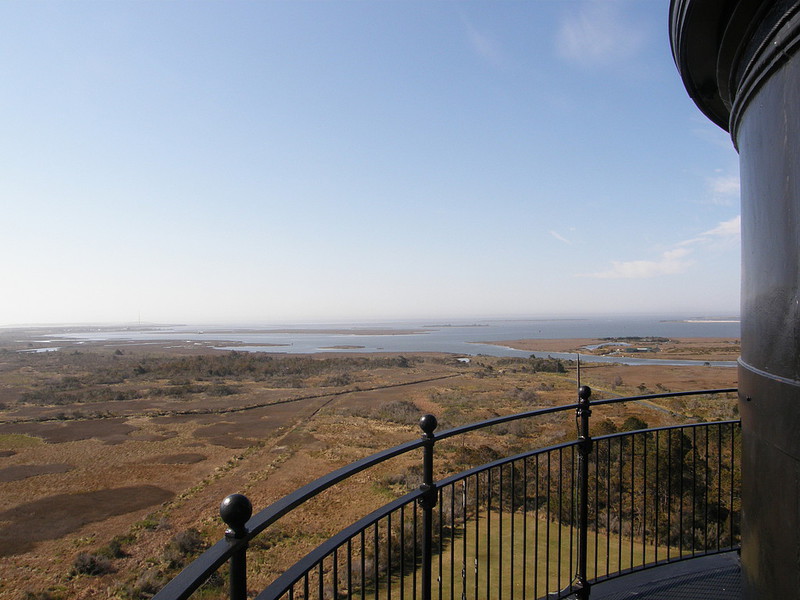
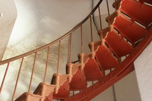
Because of the way the Bodie Island lighthouse’s stairs are constructed, the number of guests able to climb them in any given day is limited to approximately 350, and visitors will only be able to climb to the top as part of a ranger-led tour. Those interested in making the ascent should plan on getting to the visitor center inside the former lightkeeper’s quarters early enough in the morning to reserve a spot for one of that day’s tours. The lighthouse is 170 feet tall, has a spiral staircase with ten landings and 214 steps, and a first-order Fresnel lens. The beacon stands only a few miles south of Nags Head along historic NC 12, within the protective confines of the Cape Hatteras National Seashore. Views from the tower’s balcony are all one could hope for! Due east, the Atlantic Ocean spills wave after wave along unspoiled, undeveloped Coquina Beach; due south, Oregon Inlet and the William Bonner Bridge are easy landmarks to spot; to the southwest, edged by marshland that gives safe haven to migratory shorebirds, Pamlico Sound stretches out as far as the eye can see; to the northwest is picturesque Roanoke Island, home to an abundance of cultural attractions; and due north is Nags Head, Kill Devil Hills, and Kitty Hawk. In addition to climbing the tower, visitors can take a short walk to a wildlife observation deck overlooking a freshwater pond. Climbs are given between 9-4:30 daily and cost $7.00 per person. 252-473-2111

Bodie, Hatteras, and Ocracoke Islands
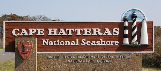
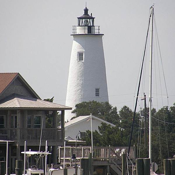
Cape Hatteras National Seashore begins just south of Whalebone Junction and stretches north to south across Bodie, Hatteras, and Ocracoke Islands. Towards the northern end of the seashore, the iconic William H. Bonner Bridge crosses Oregon Inlet, connecting Bodie and Hatteras Islands; toward the southern end, the Hatteras Inlet ferry links Hatteras and Ocracoke Islands. Famous -- and somewhat controversial -- NC 12 runs the length of the seashore. Eight villages are found along this water, wind, and sand-swept highway -- Rodanthe, Waves, Salvo, Avon, Buxton, Frisco, Hatteras, and Ocracoke -- but they are not part of the park. Three Outer Banks lighthouses are located within the national seashore: Bodie Island, Cape Hatteras, and Ocracoke. Pea Island National Wildlife Refuge is located between Oregon Inlet and Rodanthe.

Rodanthe - 23645 NC Highway 12
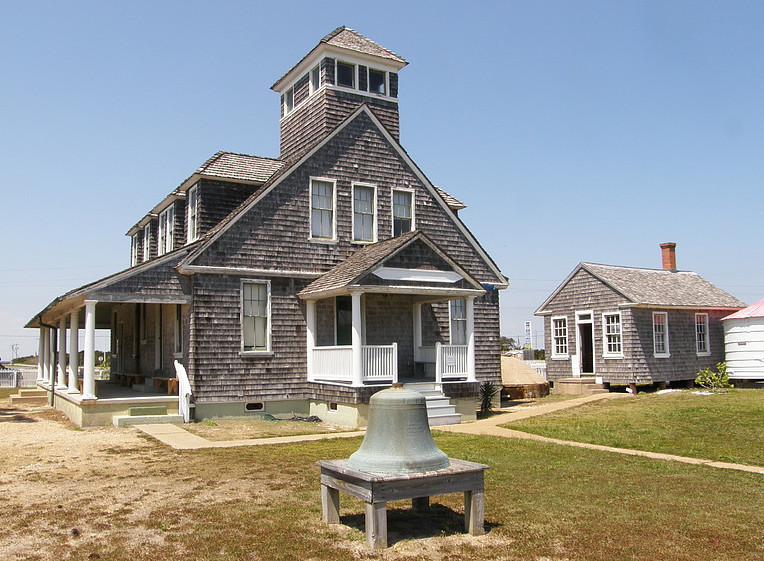
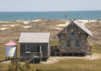
Chicamacomico Life Saving Station Historic Site in Rodanthe preserves the heritage of the “surfmen” of the US Life Saving Service, the dedicated men of a bygone era who put their lives at risk to save victims of shipwrecks. The Life Saving Service formed gradually over a 23-year period from 1848-1871. Beginning in 1874, life-saving stations were constructed along the North Carolina coast at six to seven mile increments. The Chicamacomico Banks station, built in 1874, is the oldest in the state. From an Indian word meaning “land of shifting sands,” Chicamacomico Banks served as the name for several small Hatteras Island villages. The US Postal Service determined the name was too long for practical purposes and created the Rodanthe, Avon, and Salvo addresses we have today.
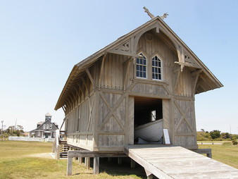
Because of the area’s remoteness, the 1874 station was designed as a pre-fabricated, timber frame structure, built elsewhere, then shipped to the coast and reassembled with wooden pegs on the present site. When a new, larger station was completed in 1911, the original building served as a boat-house. After the station was closed, the site gradually fell into disrepair, but conservation efforts begun in 1997 have done much to restore the main buildings and dependencies to their original appearance. Items on display in the boathouse include a replica beach cart, carrying all the assorted tools necessary to affect a rescue, and an original, horse-drawn “surfboat.” The design of this lifeboat is patterned after early 19thcentury whaling boats, double-ended to help the craft ne-
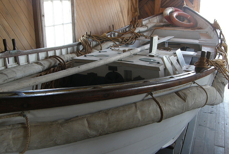
gotiate breaking waves while journeying offshore and falling waves while coming back. The 1911 stationhouse is a two-story structure similar in appearance to modern beach houses. The rooms contain numerous exhibits that convey what life was like for the men garrisoned at Chicamacomico, showcase equipment and rescue procedures, and detail some of the more notable rescue efforts. Among the most famous of these was the Chicamacomico station’s 1918 rescue of British seamen from the tanker Mirlo, torpedoed six miles offshore by a German U-boat, and the 1896 rescue by Pea Island station surfmen of victims of the E. S. Newman shipwreck. Such rescues were the rule rather than the exception. From 1871 to 1915, when it merged with the U. S. Revenue Cutter Service to form the U. S. Coast Guard, the Life Saving Service rescued over 177,000 victims, at a loss of 1,000 of their own. This dedication to duty was summed up in the grim words a veteran station keeper gave to his crew: “The book says you have to go out, it don’t say nothing about coming back.”
A ladder on the second floor takes visitors to the observation tower, which offers panoramic views of the Atlantic Ocean and Pamlico Sound. Surfmen stood four hour shifts in this confined tower, keeping constant watch for ships in trouble on either side of Hatteras Island. A third building open to the public is another boathouse, used today to showcase artifacts from local shipwrecks. The site is family-oriented, and daily programs include such activities as storytelling and knot-tying demonstrations. The Life Saving Station is on NC 12, one of the state’s most famous highways. Hours are 10-5 Monday through Friday from April through November. Admission charged. Tours are self-guided; various special programs are offered frequently, and a gift shop specializing in nautical items is located on the premises. Picnic facilities are available. 252-987-1552
Manteo
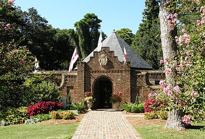
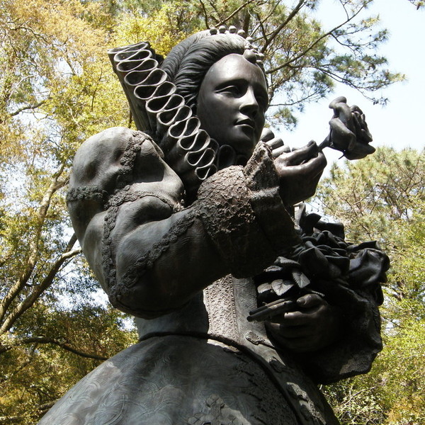
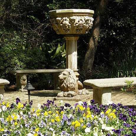
The Elizabethan Gardens, adjacent to Fort Raleigh National Monument, have been a Roanoke Island treasure for more than half a century. The Gardens opened August 18, 1955, the 368th anniversary of the birth of Virginia Dare, the first child of English descent born in America. A living memorial to America’s original English colonists, this horticultural paradise features a wide variety of plants, shrubs, wildflowers, and trees. Carefully landscaped walks guide visitors to many points of interest, including the famous statue of Virginia Dare, sculpted in Italy by Maria Louisa Lander and donated to the Gardens by Paul Green. Other focal points include the picturesque Sunken Garden, centered on an antique Italian fountain, the Shakespearean Herb Garden, the Queen’s Rose Garden, and a 9-foot statue of Queen Elizabeth I herself, the largest such statue in the Queen's honor in the world. The Elizabethan Gardens are open daily year-round, except Thanksgiving, Christmas, and New Year’s Day. Hours vary seasonally. Admission charged. 252-473-3234


Manteo

Fort Raleigh National Historic Site preserves the site on Roanoke Island of the first English settlement in the New World. The ultimate fate of these courageous settlers, who established their colony in 1587, remains unknown, providing us with American history's first mystery. Films, artifacts, and ranger talks provide information about the colony’s history and the various Indian tribes that originally inhabited the region. A small, triangular-shaped earthenwork “fort” has been reconstructed on site behind the visitor center.

Frisco
Frisco Native American Museum & Natural History Center has been one of the most interesting cultural and historical attractions on the Outer Banks since 1987. Promotional material for the site invites visitors to “enjoy, admire, reflect, and learn” about the earliest inhabitants of Hatteras and neighboring islands. Toward that end, artifacts displayed include basketry, weaving, pottery, and bead work. Also featured is an extensive collection of stone artifacts, pipes, and music instruments; visitors are encouraged to beat the Museum’s Hopi Kiva drum. The site is especially proud of its ancient dugout canoe, which was actually discovered on the property. A collection of native wild animals is exhibited, and there is a self-guided Nature Trail that winds its way through several acres of maritime forests. Hours are 11-5 Tuesday through Sunday. A nominal admission is charged. 252-995-4440
Buxton
The Graveyard of the Atlantic Museum is only minutes away from the Cape Hatteras Lighthouse and within sight of the Hatteras-Ocracoke ferry dock. The design of the building's exterior suggests the skeletal hull of a sunken sailing ship. Inside, artifacts tell some of the amazing stories of the ships that have challenged – and succumb – to the treacherous waters off Cape Hatteras. More than 2,000 ships have sunk off Hatteras and Ocracoke islands alone, and more than 5,000 along the entire North Carolina coast. The museum is still relatively new and has just begun finding its sea legs. One display explores the career of Billy Mitchell, among the first military officers to appreciate the potential of aircraft for military purposes. Information about and artifacts from the Union ironclad USS Monitor are also displayed; the famous gunboat sank during a storm off the Hatteras shore in 1862. Then there is the haunting story of “the ghost ship of Diamond Shoals,” the 5-masted Carroll A. Deering. This beautiful schooner ran aground on Hatteras’ Diamond Shoals in January, 1921, under full rigging but absent her crew. What happened aboard the Deering remains a maritime mystery. Yet another startling artifact is the telegram found at the US Hatteras Weather Station reporting the CQD ["Come Quickly Distress"] message received from the "unsinkable" luxury ocean liner Titanic the morning she slid under the waves and onto the front pages of newspapers around the world. And there are many more fascinating artifacts to be seen. The museum's pride and joy, however, is the original 1854 Fresnel lens that had first been installed in the current lighthouse's predessor. Removed for safekeeping, it was misplaced for a time, and its whereabouts was unknown for decades. It was eventually rediscovered, found, to the surprise of everyone, exactly where it was originally intended to be, atop the new Hatteras lighthouse! The Graveyard of the Atlantic Museum is one of North Carolina's three maritime museums; the other two are in Beaufort and Southport. Hours are 10-4 Monday through Friday. Admission is free. 252-986-2995
Buxton
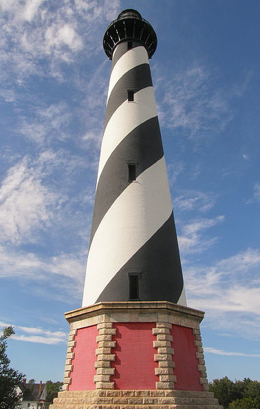
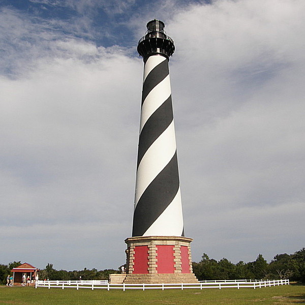
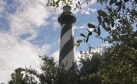
Hatteras Lighthouse, with its barber-pole striped paint scheme, is one of North Carolina's most recognizable structures. Just under 200 feet in height, it is the tallest masonry lighthouse in the world. The Charlotte Observer listed this sturdy sentinel among the "Seven Wonders of the Carolinas," and it truly is a "must-see" attraction for any Tar Heel traveler. Five light-houses illuminate the thin ribbon of land that makes up North Carolina’s famed Outer Banks. Currituck and Bodie Island beacons stand to the north; Ocracoke and Cape Lookout lights are off to the south. Square in the middle stands Cape Hatteras, built in 1870 to warn sailors of the dangerous Diamond Shoals. Over the years, the Atlantic Ocean relentlessly crept closer and closer to the base of the lighthouse. When constructed, the tower stood 1,600 feet from the shoreline, but by the late 1990s the beacon was perilously close to the waters of the Atlantic. aAfter years of spirited debate, the Coast Guard made the decision to
have the tower moved inland. In what was accurately dubbed a “monu-mental move,” the beacon was painstakingly lifted off its base, placed on a rolling platform, and slowly moved 2,900 feet to the southwest, restoring it to its original distance of 1600 feet from the ocean. The three-week move took place between June 17 and July 9, 1999, prompting one witty Charlotte Observer letter writer to observe that, while the Hatteras beacon had always been the tallest lighthouse, it was now also the fastest!

Soon after the move was completed, the tower reopened to the public for climbing. The 136-year-old tower seems to have retained its appeal, as thousands of visitors each year clamor to climb its 269 steps. Those who do are rewarded with breathtaking vistas. From the observation deck it is easy to see the route the lighthouse traveled. Visitors to the old site will find stones in which the names of lighthouse keepers over the years have been carved in tribute to their services. Visitors to the Hatteras light can also enjoy the nature trail that winds through Buxton Woods, a 500-acre maritime forest. A visit to the nearby Graveyard of the Atlantic Museum is a perfect compliment to climbing The Old North State's iconic beacon.
Manteo
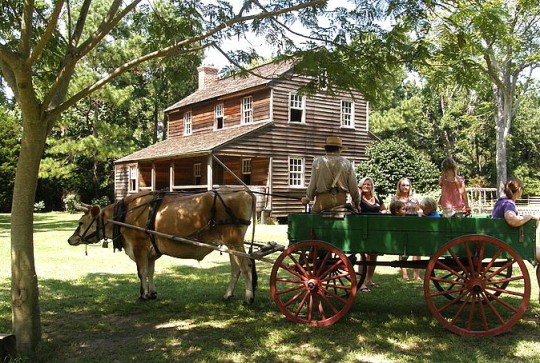
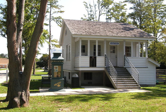
Island Farm is a living history site that interprets daily life on Roanoke Island in the mid-1800s. The core property originally belonged to the Etheridge family. Adam Etheridge built the farmhouse about 1847, and it is the oldest restored house on Roanoke Island. Self-guided tours include an orientation center, the main farmhouse, and such dependencies as the cookhouse, smokehouse, barn and chicken coop, and privy. Five slaves lived and worked at the Etheridge farm at the start of the Civil War, and a representative two-room slave cabin is also on site. It comes as a surprise to many visitors to find a restored windmill on the property; in the 1800s, however, windmills were common fixtures on Roanoke, Bodie, Hatteras, and Ocracoke Islands. Interpreters in period attire are on hand every day the site is open, engaged in the routine activities of the day – tending the garden, feeding the animals, washing the laundry, preparing the daily meals, and blacksmithing. Ox-drawn wagon rides, included as part of the admission price, are given throughout the day. Island Farm is open 10-4 Wednesday through Saturday from early April through late November. Admission charged. 252-473-6500
Nags Head
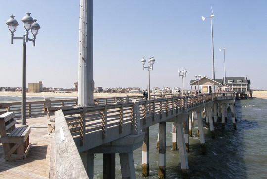
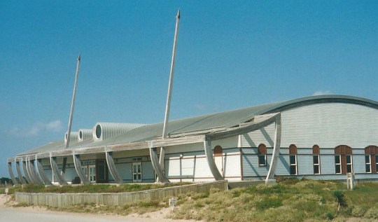
Jennette's Pier stands at the very heart of Nags Head’s Whalebone District. The current structure is a new and improved version of the original pier built here in 1939. Warren H. Jennette, Sr., and the Jennette Brothers began construction of the original pier on May 22, 1939, choosing to locate it near the site of the former “Transient Camp” built by the WPA in 1933 and occupied by some 1,500 workers responsible for building protective sand dunes along the Outer Banks. Work was completed by July of that year and a 16-foot wide wooden pier extended 754 feet into the Atlantic Ocean, with a 28-foot wide deck forming a “T” at the end. It was Nags Head’s first fishing pier and became a landmark for vacationers. Damaged many times over by hurricanes and nor’easters, the pier was always repaired and improved upon, remaining a favorite destination point for anglers for more than sixty years. The Jennette family finally sold its interest in the property, however, and in 2003, the North Carolina Aquarium Society bought the pier for the purpose of establishing an educational outpost on the ocean. Hurricane Isabel knocked a whole in that plan, however, along with about 540 feet of the pier itself, in September of that same year, resulting in an altogether new approach.
Rather than repair the wooden structure yet one more time, a new strategy was adopted. Ground-breaking on an all-concrete, 1,000-foot-long educational pier took place on May 22, 2009, the 70th anniversary of when work began on the original pier. The educational exhibits add to the experience, but fishing is still the pier’s main attraction. Red drum, bluefish, striped bass, flounder, and king mackerel are among the common catches. May through August, the pier is open from 5 AM until midnight; hours in April, September, October, and November are 6 AM until midnight; and December through March, hours are 8-5. Fees are charged for fishing; and there is a nominal charge to walk on the pier.
Nags Head
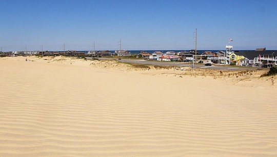
Jockey’s Ridge State Park encompasses an 80-to-100 foot sand dune at Nags Head where nature has provided an oversized “sandbox” where children and adults alike may play. Like too many natural settings that are taken for granted, Jockey’s Ridge, the tallest sand dune system in the eastern United States, was threatened by development in the early seventies before local residents took action to protect it. In 1973, bulldozers were literally at the base of the dune, ready to clear land for a residential project, before the state stepped in to preserve this OBX treasure. Petitions to local and state governments to “Save Our Sand Dune” resulted in a recommendation by the N. C. Division of Parks and Recreation to establish a state park. Today, the park encompasses 420 acres of wind-swept sand. And "sweep" accurately describes what the wind does. Jockey’s Ridge is never quite the same from one season to the next. In the winter, the winds normally blow from northeast to southwest; during the summer, winds blow from southwest to northeast. The result is that Jockey’s Ridge is constantly “jockeying” back and forth.
Although the nature of the dune prevents the construction of traditional trails, the park does feature “Tracks in the Sand,” a 1.5 mile walk composed of fourteen stations. The trail leads east to west across the dune, starting at the main parking lot and meandering over to the Roanoke Sound. Along the way, walkers might spot the tracks of some of the park’s other visitors – fox, deer, and, of course, a variety of shorebirds. Hikers can also look for fulgurites, glass tubes formed by lightning striking the sand. A 360-foot handicap-accessible boardwalk near the parking area provides interpretive displays and an overlook. The Soundside Nature Trail winds through grassy dunes, maritime thickets, and wetlands. The main attraction, of course, is the dune itself. From the summit, one can enjoy sweeping views of the Atlantic to the east, the Roanoke Sound to the west. Hikers are cautioned to wear shoes to protect feet from sandspurs at any time of the year, and from burning sand during the hot summer months – sand temperature can sometimes be as much as thirty degrees higher than air temperature. Thanks to all-terrain vehicles operated by park staff, the top of Jockey’s Ridge is handicap accessible. Call the park office 24 hours in advance to make necessary arrangements. Hikers need to keep an eye out for hang gliders. Just as the winds of Kitty Hawk, only a few miles to the north, attracted Orville and Wilbur Wright more than a hundred years ago, the 10-to-15 miles per hour winds which are usual for Jockey’s Ridge make the dune an ideal spot for hang gliding – easy take-offs and soft landings. Participants are required to have a USHGA Hang 1 or other agency-approved rating. Kite flying is another popular pastime.
The park opens at 8 AM daily, year round. Closing hours are 9 PM June through August; 8 PM April, May, and September; 7 PM March and October; and 6 PM November through February. The ridge area closes fifteen minutes before the park closes. Admission is free. A visitor center and picnic facilities are located at the main entrance. A smaller access off Soundside Road also provides parking. 919-441-7132
Kitty Hawk

The Monument to a Century of Flight was dedicated in 2003, the 100th anniversary of powered flight. The monument consists of fourteen wing-shaped steel pylons, ascending in height from 10 to 20 feet, and circling a six-foot bronze dome depicting the continents of Earth. The faces of the pylons feature black granite panels engraved with the date and synopsis, sometimes accompanied by an image, of one hundred of the most significant accomplishments in the first century of aviation. North Carolina artist Glenn Eure developed the preliminary concept for the monument, with the finished design the result of the collaborative efforts of Eure and two other NC sculptors, Hanna Jubran and Jodi Hollnagel Juban. At the entrance to the monument is a granite marker inscribed with the poem “High Flight” by 19-year-old American pilot James G. Magee, Jr. in late 1941. Serving with the Royal Canadian Air Force in Britain, Magee was killed in combat over England in December of that year. The Monument is located on the hill behind the Aycock Brown Welcome Center on US 158 in Kitty Hawk.
Nags Head
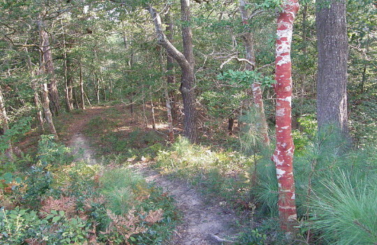
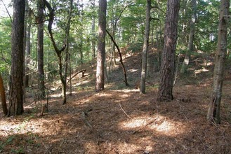
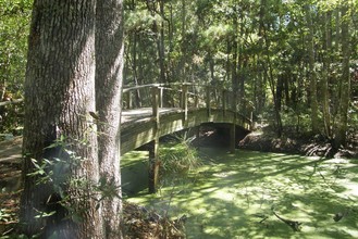
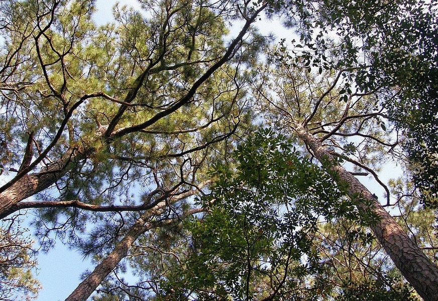
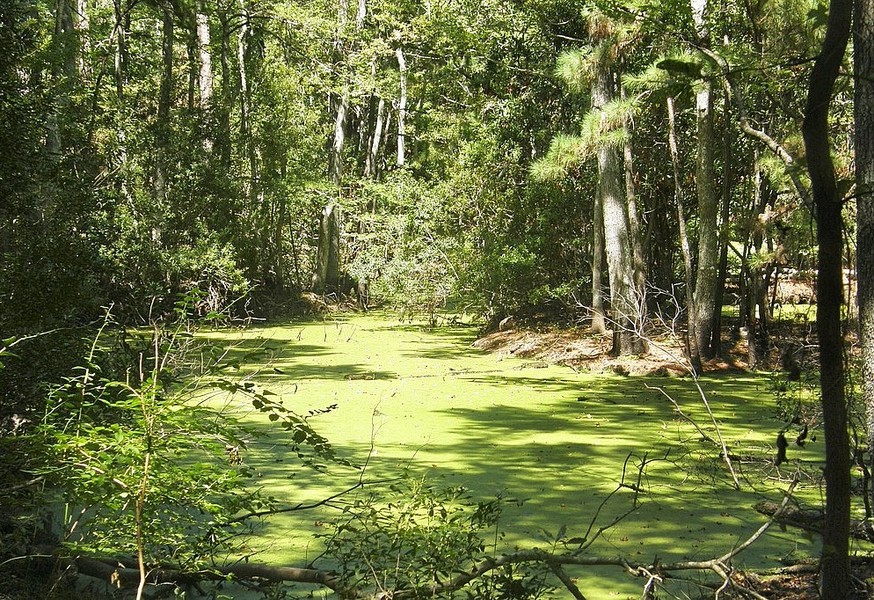
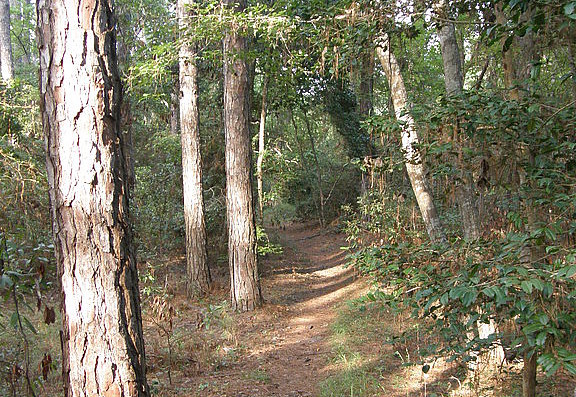
Nags Head Woods Preserve is exactly the kind of place the non-profit Nature Conservancy was intended to protect. Established in 1951, the Conservancy’s goal is to protect land and water, preserving natural habitats upon which plants and animals depend. In its sixty years of existence, the organization has managed to protect more than 118 million acres and land and 5,000 miles of river across the country and around the world. Since 1977, the Conservancy has been working in partnership with the towns of Nags Head and Kill Devil Hills to protect a 1,400-acre maritime forest bordering Roanoke Sound. The environment here is vastly different from that found in its immediate surroundings.
The terrain at Nags Head Woods Preserve is somewhat surprising. Anyone familiar with the North Carolina Outer Banks knows that most of the land is only a few feet above sea level. Well-known – and well-visited – exceptions are the sand dunes at Jockeys Ridge State Park and the hill upon which the monument stands at the Wright Brothers National Memorial. The Preserve encompasses similar dunes, different from the others in that they are covered over with vegetation. These wooded hills give visitors a sense that they are hiking along some pleasant trail in the foothills, rather than being only a mile or so from the Atlantic surf.
The change in elevation within the Preserve leads to some noticeably different natural communities. Nags Head Woods contains a swamp forest, including such tree species as sweet gum, red bay, and black willow; a shrub forest, dominated by wild grasses and bushes; and a deciduous forest, thick with oak, beech, hickory, and, of course, loblolly pine trees. There’s an abundance of animal life at the Preserve as well – 50 species of birds; a variety of reptiles, amphibians, and fish; and many relatively small-sized mammals. White-tailed deer are about the largest animals one is likely to see. Most of the smaller animals are harder to spot, tending to do their roaming at night.
No less than seven nature trails await visitors. Center Trail, an easy quarter-mile loop featuring two wooden bridges, serves as a nice introduction to the Preserve. Sweetgum Swamp Trail is the Preserve’s most heavily trafficked and is a moderate, 2-¼ mile trek over several steep sand dunes. Blueberry Ridge Trail branches off from Sweetgum, adds another 1-½ miles, and elevates the walk to strenuous; this walk loops around a pond and offers scenic views. Roanoke Trail leads through a salt marsh and dense forest to end at a small beach on the Roanoke Sound; it’s a moderate, 1-½ mile round trip. The ADA Trail, designed for those with disabilities in mind, is a ½-mile paved loop that opens the Nags Head Woods experience to everyone. The Preserve is open daily from dawn until dusk. Admission is free. 252-441-2525


Manteo
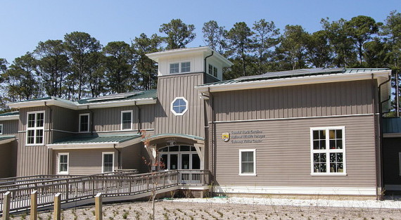
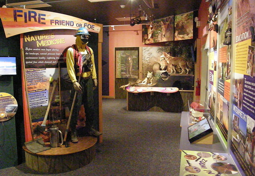
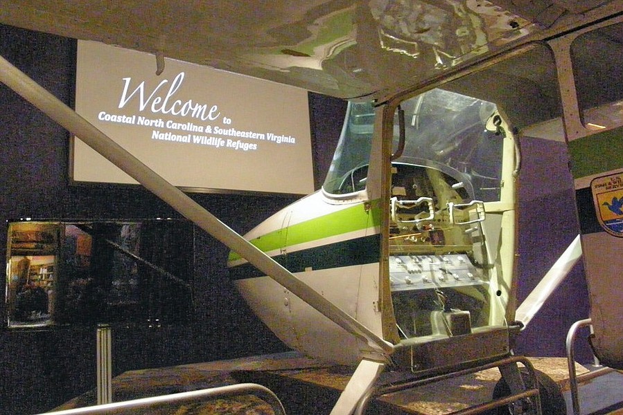
The National Wildlife Refuges Gateway Visitor Center in Manteo opened in June, 2012, and serves as a “hub” for a fish hatchery and eleven wildlife refuges, all but one of which are located in North Carolina. The spacious building includes several dioramas, one spotlighting the red wolf, a protected species making a strong comeback at the nearby Alligator River refuge since being reintroduced in 1987. A small theater shows videos on the area’s natural resources, the changing coastal plain, and the gone-but-not-quite-forgotten town of Buffalo City. The most engaging exhibit may be the cut-away Cessna airplane, which allows visitors to take simulated “fly-overs” of all of the refuges represented at the Center: Alligator River, Back Bay (in Virginia), Cedar Island, Currituck, Edenton Fish Hatchery, Great Dismal Swamp, Mackay Island, Mattamuskeet, Pea Island, Pocosin Lakes, Roanoke River, and Swanquarter. Many of these places are also a part of the informal Charles Kuralt Trail. The Visitor Center is located at the north end of Roanoke Island, near Fort Raleigh, the Elizabethan Gardens, and the North Carolina Aquarium at Roanoke Island.
Manteo
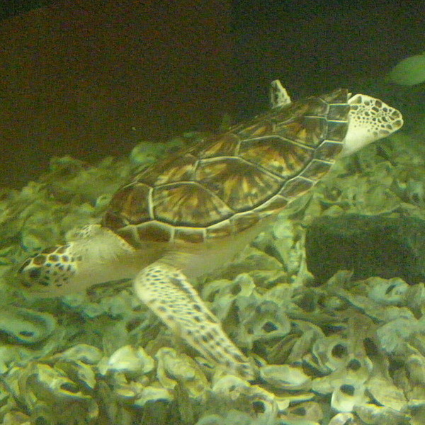
The North Carolina Aquarium at Roanoke Island occupies a pleasant spot overlooking Croatan Sound. While most states are fortunate to have one aquarium to educate and entertain its residents, North Carolinians actually have three newly-renovated, greatly expanded, and much improved regional aquariums from which to choose. Individually, none is as grand or spacious as the Georgia Aquarium in Atlanta, the South Carolina Aquarium in Charleston, or the Tennessee Aquarium in Chattanooga. Collectively, however, the Tar Heel aquariums provide visitors with a balanced look at aquatic life across the state. Each of the three NC aquariums focuses on a different aspect of aquatic life. Visitors to the Roanoke Island facility get to explore “The Waters of the Outer Banks.” This aquarium's 285,000-gallon tank features thousands of fish swimming about a scale model of the famous Civil War ironclad USS Monitor, which sank off the Cape Hatteras coast during a storm in December, 1862. There are scuba diving and feeding shows in the big tank daily. In addition to the “Graveyard of the Atlantic” exhibit, the facility features a “Coastal Freshwater” exhibit populated by pickerel, perch, and bass, and a “Wetlands on the Edge” zone, filled with alligators, otters, and turtles. Hours are 9-5 daily year-round. Closed Thanksgiving, Christmas, and New Year’s. Admission charged. The aquarium has an extensive calendar of special activities throughout the year. 866-332-3475

Manteo
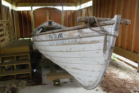
The Pea Island Lifesaving Station is historically significant because it was the only lifesaving station in the United States manned by an all-black crew. Many of these surfmen were from Manteo or Roanoke Island. The Town of Manteo and its non-profit partners are in the process of preserving this important part of its history. Already on the grounds of Manteo's Collins Park is the original, fully-refurbished Pea Island Station cookhouse. A replica boathouse shelters a surf boat similar to that used by the Pea Island crew, on loan from the National Park Service. Among artifacts displayed inside the 483-square-foot cookhouse are such tools of the trade as flares, signal lanterns, a telescope, a megaphone, and a breeches buoy. A life-sized bronze statue of Richard Etheridge, the country's first African-American U. S. Lifesaving Service Keeper, faces the cookhouse. Etheridge was in charge of the Pea Island Station from January, 1880 to May, 1900. Future plans call for the construction of a replica of the crew’s quarters. Posted tour times for this site are 11-3 on Mondays, Wednesdays, and Fridays. 252-489-0847
South of Oregon Inlet
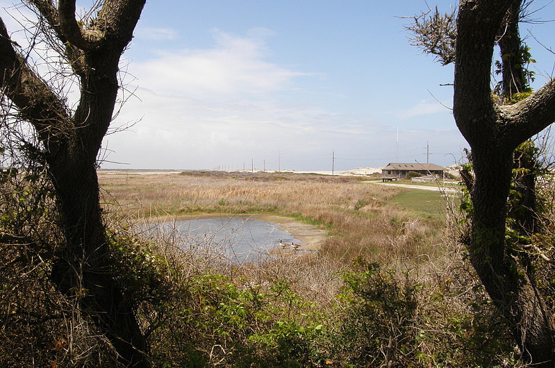
Pea Island National Wildlife Refuge is one of the stops along the informal Charles Kuralt Trail. This wildlife sanctuary covers a 12-mile ribbon of land between the Atlantic Ocean on the east, Pamlico Sound on the west, Oregon Inlet on the north, and the village of Rodanthe on the south. Situated at the midway point of the Atlantic Flyway, Pea Island is a critical feeding and resting area for migrating shorebirds and wintering waterfowl and wading birds. Established by an Act of Congress and a Presidential Executive Order in 1937, the 5,834-acre refuge encompasses ocean beach, barrier dunes, salt marshes, and fresh and brackish water ponds. Another 25,700 acres within Pamlico Sound also come within the boundaries of the refuge.
The name “Pea Island” comes from a plant which grows on the island and produces a small bean or pea. Known as “dune peas,” these plants are an important food source for many of the migratory birds, especially snow geese. Originally, Pea Island was wide, flat, and regularly washed over by Spring tides. To create the refuge, the federal government set about purchasing the land from members of several private waterfowl hunt clubs. Following this, the Civilian Conservation Corps and the U. S. Army Corps of Engineers constructed artificial sand dunes to stabilize the island. After the dunes were established, a series of artificial ponds were built; these impoundments are at the heart of today’s carefully-managed program and its resulting wildlife oasis.
While the refuge is quite literally “for the birds,” numerous activities await visitors. With mile after mile of pristine beach, Pea Island offers excellent opportunities for swimming, surfing, sunbathing, shelling, and surf fishing. On the sound side, there are two nature walks running along either side of the North Pond. Both trails feature overlooks and are handicapped-accessible. The Visitor Center features a picture window overlooking North Pond to provide still more opportunities to view wildlife. It is worth noting that the cost to build and maintain this visitor center was raised by a non-profit group of refuge volunteers, and this group continues to provide the people needed to keep the center open seven days a week through most of the year. Visitor Center hours are 9-4 daily from April 1 through November 30, and Thursday-Sunday from December through March.
Manteo
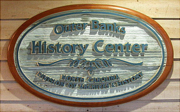
The Outer Banks History Center is a regional archives and research library located within the Roanoke Island Festival Park complex. Administered by the State Archives of North Carolina, the center’s core collection was donated by famed Outer Banks author, historian, businessman, and civic leader David Stick in 1986. Since that time, additional historical documents have been received from such organizations as the Roanoke Island Historical Association, the Town of Nags Head, the Dare County Visitors Bureau, The Elizabethan Gardens, and producers of The Lost Colony outdoor drama. The collection includes research material related to European discovery and exploration of North America; military history of the Outer Banks, with a special emphasis on Civil War action on Hatteras and Roanoke Islands and U-boat operations off the North Carolina coast during both World Wars; shipwrecks, lighthouses; other aids to navigation, and the U. S. Life-Saving Service and its successor, the U. S. Coast Guard; natural history and environmental sciences; and genealogy and family history.
As important at the facility is to researchers, it also offers changing exhibits of interest to the general public. The Center featured “The Civil War Comes to Roanoke Island” exhibit in 2012; for most of 2013, the featured exhibit is “Dare County in the 1930s.” This collection includes information about the construction of the Wright Brothers bridge, which forever changed the nature – figuratively and literally – of the Outer Banks; the dedication of the Wright Brothers Memorial; changes to Fort Raleigh National Monument; artifacts from The Lost Colony’s initial season and the visit of President Franklin Roosevelt; a reproduction of the first edition of Dare County’s first newspaper dated July 5, 1935; and more.
Manteo
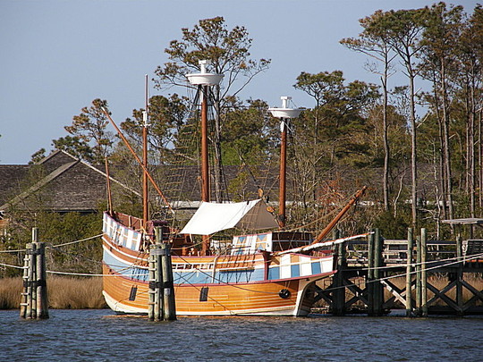
Roanoke Island Festival Park is located across from Manteo’s picturesque waterfront along Shallowbag Bay. Situated only a few miles from the site of the original settlement, Festival Park is an engaging family attraction that celebrates the first English colony in America. The highlight of the park may well be the Elizabeth II sailing ship, a representative 16th century vessel. Onboard the Elizabeth, visitors are free to explore above and below deck, stretch out in the “spacious” captain’s quarters, or scan the horizon from the quarter deck. They can try "learning the ropes,” practice navigational skills, and perhaps witness the firing of the ship’s swivel gun. The Coastal Algonquian culture is examined in the American Indian Town, with its longhouse, dancing circle, and planting area. Hands-on visitor activities here might include mending nets, tanning hides, weaving baskets, making ropes, or helping to scrape out a canoe. At the Settlement Site, visitors may well find a blacksmith plying his trade, a soldier readying his weapons and armor, or a carpenter fashioning some needed item for the camp. Visitors might find themselves called upon to assist in some of these activities as well.
Inside, the Roanoke Adventure Museum covers more than 400 years of Outer Banks history with lots of inter-active exhibits that will entertain and inform young and old alike. There is also a 45-minute film entitled “The Legend of Two-Path” that deals with the American Indians’ reaction to the arrival of the English. Roanoke Island Festival Park is open 9-5 daily from March 1 through December 31; closed some holidays. Admission charged. 252-475-1500
Manteo
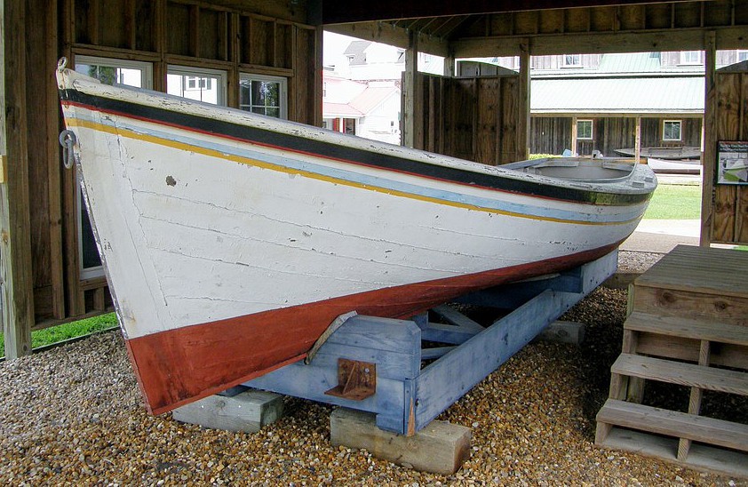
The Roanoke Island Maritime Museum is located in the George Washington Creef Boathouse, occupying a choice spot on Shallowbag Bay and adding to the charm of Manteo’s downtown area. The boathouse was named for the local builder who developed the Shad boat, a particular style of workboat specifically designed for use in the North Carolina sounds. The craft became so widely used that the North Carolina legislature eventually named it the “official” state boat. It is appropriate, therefore, that an 1883 Creef Shad boat is one of several small craft exhibited at the Museum. Inside the building, visitors will find a working boathouse, where staff and volunteers are often busy on such projects as small craft restoration and new boat construction. One sizeable, and highly visible, project constructed at the boathouse was the Elizabeth II, a representative composite of the kind of 16th-century ships that first brought colonists to Roanoke Island in the 1580s.
Manteo
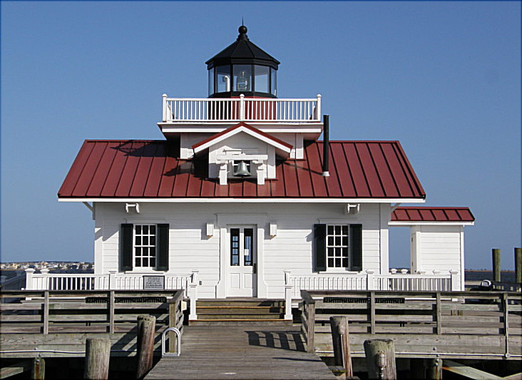
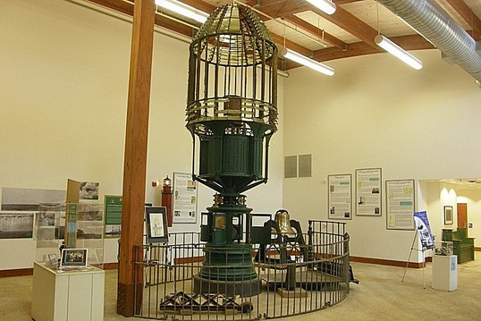
Something new was added to Manteo’s historic waterfront in the fall of 2004 – a replica of the Roanoke Marshes Lighthouse which once stood at the southern entrance to Croatan Sound near the Roanoke Island town of Wanchese. The exterior is a faithful representation of the original, square, cottage-style, screwpile lighthouse, built in 1877 and operated by the US Coast Guard until it was decommissioned in 1955. The original was lost later that same year during an attempt to move it to private property. The new lighthouse employs a 4th order Fresnel lens built in France in the 1800s; its fixed white light actively serves as a navigational aid to boats coming into Shallowbag Bay.
Kitty Hawk

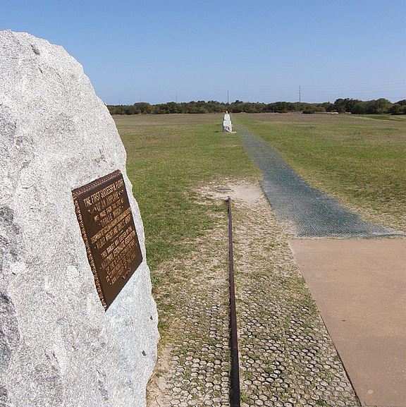
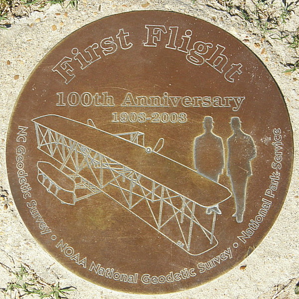
The Wright Brothers National Memorial pre-serves the site where two inquisitive, industrious, and indominable brothers first achieved powered flight. The 100th anniversary of Wilbur and Orville’s first flight, which occurred on December 17, 1903, drew large crowds to the Outer Banks. Another decade has passed and things are a little quieter, but the Memorial is every bit as exciting and worthwhile to visit. The site not only commemorates the day of the Wright Brothers’ success, but also the years of frustration Wilbur and Orville endured before seeing their vision finally become a reality. The brothers did much research during the last years of the 19th century, designing and experiment-ing in the back room of their bicycle shop in Dayton, Ohio. In time, Wilbur and Orville were finally ready to experiment with a full-sized glider. What they needed was a remote place clear of obstructions and with steady winds where they could conduct their tests in private. National Weather Bureau reports suggested that Kill Devil Hills, on North Carolina’s Outer Banks, might be a suitable location. Any visitor to the Outer Banks today would have difficulty believing the place had ever been remote, but at the turn of the 20thcentury, it was. For the most part, the only witnesses – and occasional assistants – to the Wright brothers’ experiments were the surfmen stationed at Kitty Hawk’s U. S. Life Saving Station. Orville and Wilbur conducted their first glider tests in 1900, followed by hundreds more glider flights in 1901 and 1902. The brothers returned again in September of 1903; this year, on a chilly, overcast morning in December, the Wrights wrote their names on the pages of history.
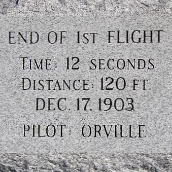
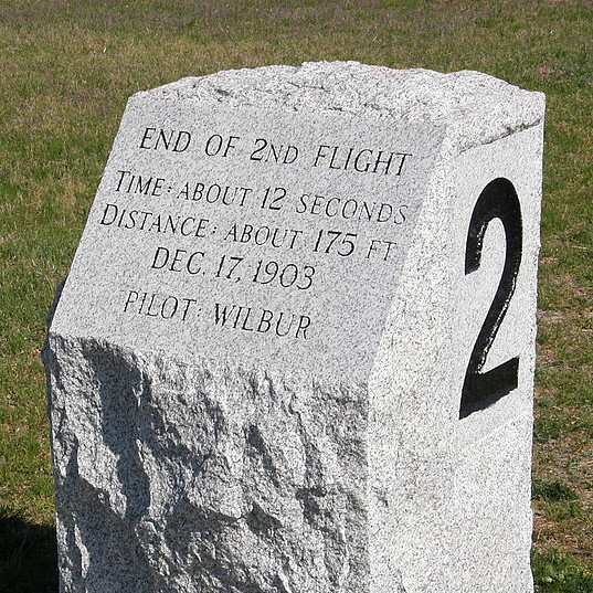
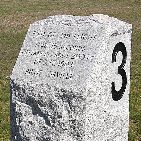
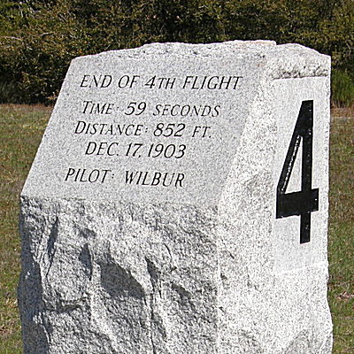
At 10:35 AM, December 17, Orville piloted the first suc-cessful flight of a heavier-than-air craft moving under its own power and landing at a place equal to or greater in height than the point of take off. Man’s “first flight” lasted a scant 12 seconds and covered a mere 120 feet, an average of less than 7 miles per hour! Orville could have gotten much farther, much faster, on one of his bicycles, but that wasn’t the point. While the younger brother had the distinction of being the first man to fly, Wilbur proved to be the better pilot, traveling 175 feet on his first try. Orville’s second flight covered a distance of 200 feet, but this was quickly outdistanced by Wilbur’s 852-foot flight. Unfortunately, this fourth flight resulted in a crash landing, causing minor damage. Before the Flyer could be repaired, strong wind gusts blew the craft across the ground, causing irreparable harm and preventing any further flights. The inventors packed up and went home, satisfied that they had indeed proven that man could fly! It would be years before the magnitude of the day’s events would be fully appreciated by the world at large.
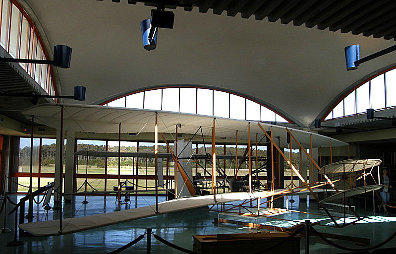
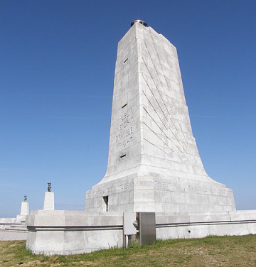
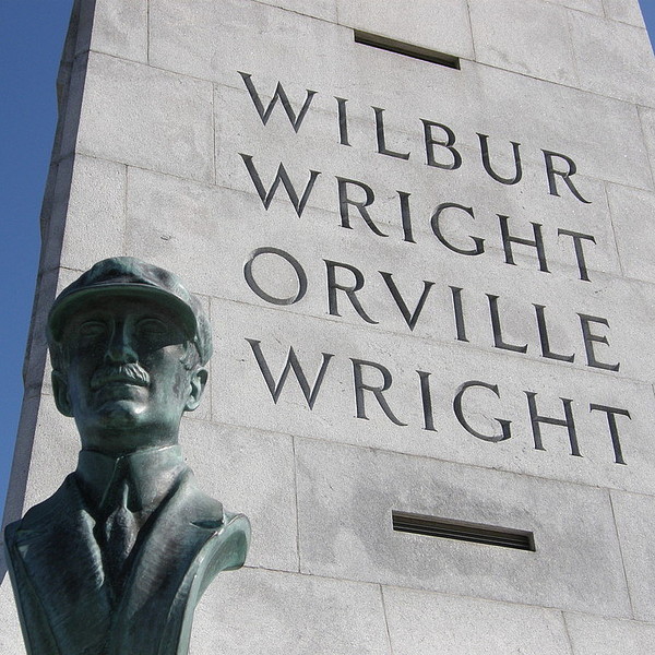
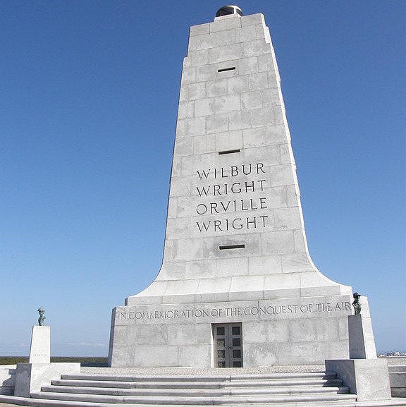
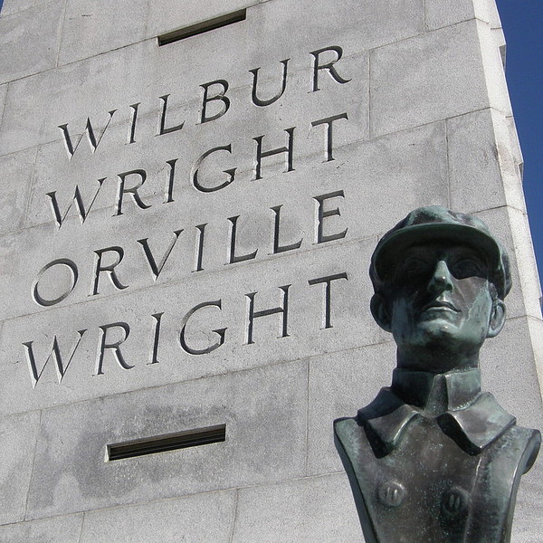
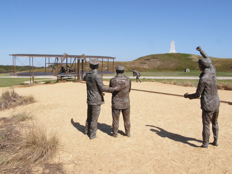
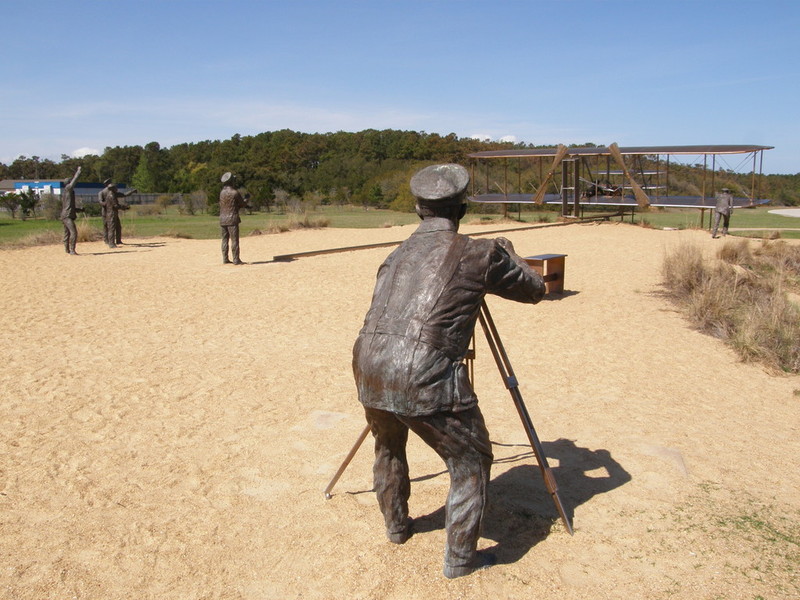
The Visitor Center includes full-scale reproductions of both the 1902 glider and the 1903 Flyer. (The actual Flyer is on display at the National Air and Space Museum in Washington, D. C.) Park rangers use the replica of the Flyer to explain how the brothers maneuvered the craft in flight. Built in 1960, the Visitor Center building is itself an architectural wonder deserving of its place on the National Register of Historic Places. Two reconstructed wooden structures, the hanger for the Flyer and the combined workshop and living quarters for the two inventors, were added to the park in 1963. A large boulder marks the spot where the flyer first lifted into the air; granite markers indicate the distances flown by Orville and Wilbur during their four historic flights on the morning of December 17. The Memorial’s most dominant feature is the 60-foot pylon, built of granite imported from Mount Airy. Groundbreaking for this impressive edifice was held in 1928, on the 25th anniversary of the first flight. Orville Wright was in attendance; another notable attendee was aviatress Amelia Earhart. Dedicated in 1932, the pylon stands atop the 90-foot Kill Devil Hill, which served often as a testing ground for the Wright brothers in the years leading up to their first flight. Added to the site in time for the centennial was "First Flight" by Stephen H. Smith, a metal sculpture of the flyer and life sized figures of Orville, Wilbur, and the crew of the life-saving station, dramatically recreating for all time the exact moment of the first lift-off. During summer, the park is open from 9:00-6:00 daily. Other seasons, the hours are 9:00-5:00 daily except Christmas. Admission charged.

Dare County is bordered by CURRITUCK, HYDE, and TYRRELL counties.
Return to REGION ONE HOME PAGE.
Return to GEOGRAPHIC REGIONS HOME PAGE.