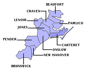
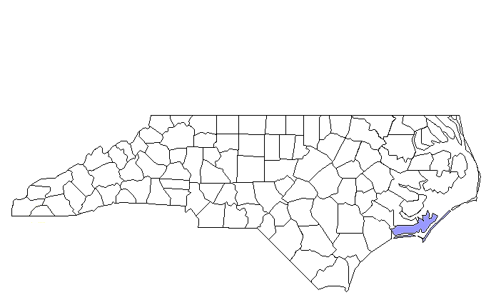
CARTERET COUNTY
Scroll down this page or click on specific site name for features on the following Carteret County attractions/points of interest:
Beaufort Historic Site, Cape Lookout National Seashore, Core Sound Waterfowl Museum, Croatan National Forest, Fort Macon State Park, The History Place, North Carolina Aquarium at Pine Knoll Shores, North Carolina Maritime Museum, "Old Burying Ground", Portsmouth Village
Fast facts about Carteret County:
Created in 1722, the county is named for John Carteret, second Earl of Granville, who inherited one-eighth share in the Province of Carolina.
The county seat is Beaufort, named for Henry Somerset, Duke of Beaufort. Other communities include Atlantic Beach, Cedar Point, Emerald Isle, Harkers Island, Morehead City, Newport, and Swansboro.
Carteret County’s land area is 519.84 square miles; the population in the 2010 census was 66,469.
It is worth noting that Beaufort, founded in 1713, is North Carolina’s third oldest incorporated town; Cape Lookout National Seashore and the Rachel Carson Nature Preserve are located in Carteret County.
Beaufort
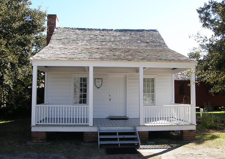
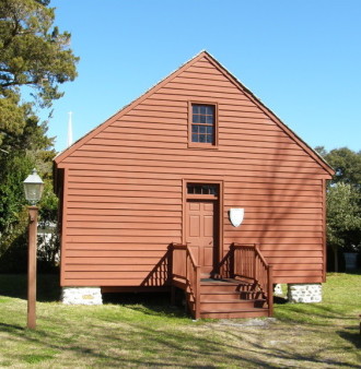
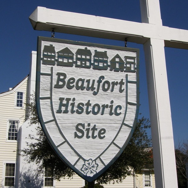
Beaufort Historic Site preserves numerous homes and public buildings of importance to this quaint seaside village. Founded in 1709 and incorporated in 1722, Beaufort is North Carolina’s third oldest town. A picturesque waterfront, a bustling business district brimming with specialty shops and fine restaurants, and a charming historic district showcasing finely restored old homes make Beaufort a popular year round destination point. The Beaufort Historical Association does its part by offering tours of several restored buildings. The three private homes on tour show differences in architectural style and level of income. The oldest is the Samuel Leffers House, dating to 1778. The “coastal cottage” is a one-and-a-half story affair containing one main room serving as kitchen and parlor, a small side bedroom, an upstairs loft, and an enclosed back porch. It was home for the town’s schoolmaster, his wife, and their four children.
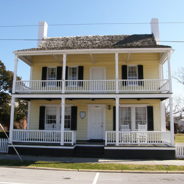
Next door to the Leffers Cottage is a considerably larger, two-story, yellow-frame house with a double porch built in 1825 by Josiah Bell, a wealthy plantation owner. In striking contrast to the schoolmaster’s home, the rooms of the Bell house are resplendent with vivid colors and expensive furnishings. Touring the home, visitors will learn about Josiah Fisher Bell, a Confederate spy who lived in the house during the Civil War and who, in 1864, participated in a raid to destroy the Cape Lookout lighthouses.
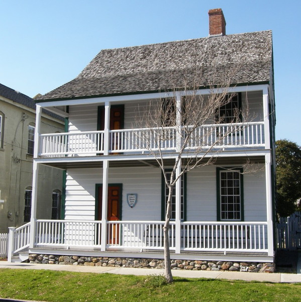
On the opposite side of the street from the Leffers Cottage and Bell House is the 1825 home owned by merchant John C. Manson. Built in the West Indian style, the house features first and second floor porches. The faux painted doors have a look of mahogany about them; the faux painted wainscoting looks like marble. The house is a treasure trove of fashionable furnishings, including a Chippendale bureau, a Sheraton sofa, a Pembroke table, and several Hepplewhite-inspired pieces.
Among the public buildings on the tour is the single-room Carteret County courthouse built in 1796; it has the distinction of being the oldest surviving wood-framed courthouse in North Carolina. The 2001 restoration returned the courthouse to its original barn-red color. The stark white, two-story county jail dates to in 1829. The building provided modest living quarters for the jailer and his family, as well as large cells with bare bone accommodations for inmates. The combination apothecary shop and doctor’s office was built around 1859. Antique medical equipment and a variety of pharmaceuticals, herbs, and home remedies are exhibited in the two-room structure. Visitors sign up for tours at the Safrit Historical Center along the 100 block of Turner Street. Two separate tours are offered Monday through Saturday. One offers visits to the three houses; the other provides visits to the public buildings. Admission charged. 252-728-5225
East of Morehead City

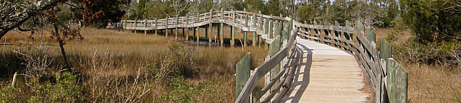
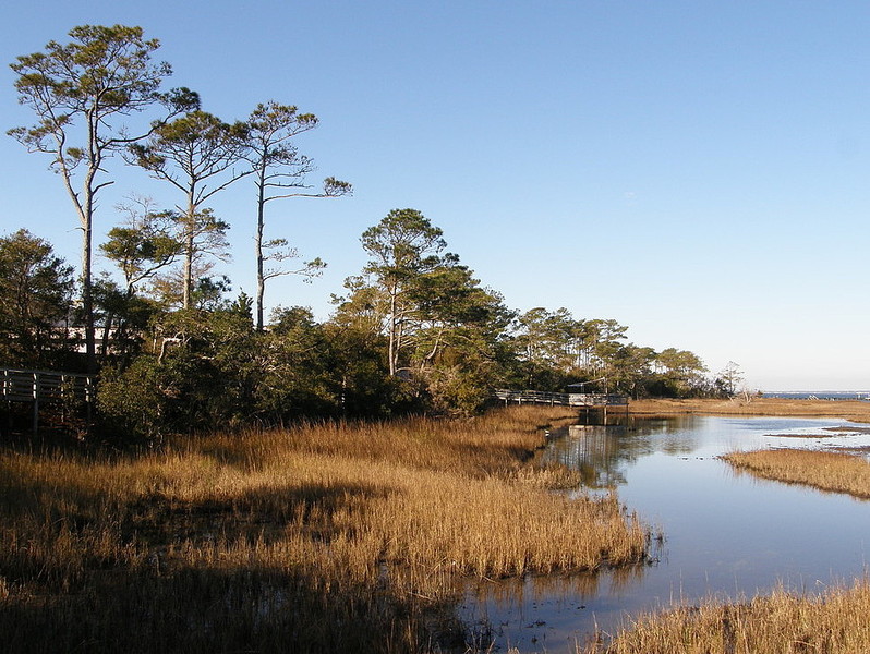
Cape Lookout National Seashore, which includes Shackleford Banks, gives visitors an opportunity to experience a part of the North Carolina coast virtually free of commercial development. From wading in the surf and combing for shells, to spotting wild ponies and touring the famed lighthouse, a day at the beach here is markedly different from one spent anywhere else along the Carolina coast. The Cape Lookout National Seashore encompasses the North Core Banks and South Core Banks, a stretch of about 45 miles running north to south, and Shackleford Banks, a narrow slip of land about one-half mile in width that stretches about nine miles east to west, from Beaufort Inlet to the Cape. At the northern end of North Core Banks, across from the village of Ocracoke, is the now-deserted village of Portsmouth, where some twenty buildings are all that remain of this once-active fishing village. At the southern end of South Core Banks, accessible by ferry from Harkers Island, is the famous Cape Lookout lighthouse.
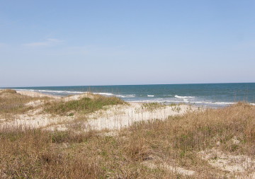
Between the ferry landing on Core Banks and the lighthouse is a protected shoreline providing a wonderful place to spread out a blanket and catch some rays, splash in the ocean, or go searching for shells. Even at the height of the summer tourist season, the beach is considerably less crowded than most other beaches along the Outer Banks; in the off-season, you will often find yourself alone, or almost so, separated from the frantic pace and steady noise of the modern world. With its distinctive diamond-shaped paint scheme, Cape Lookout lighthouse is, after Hatteras, probably the most recognizable beacon on the North Carolina coast. Built between 1857 and 1859, it rises 163 feet above sea level and has helped mariners successfully navigate the treacherous waters off the barrier islands for more than 150 years.

Until recently, the lighthouse was managed by the U. S. Coast Guard and was closed to the public. In 2003, however, the National Park Service assumed responsibility for the beacon and soon thereafter opened the tower to visitors on selected days each year. The program has proven to be very popular. Reservations are required and fill up almost immediately, so those interested in climbing the lighthouse are advised to check the park’s website well ahead of any planned trip.
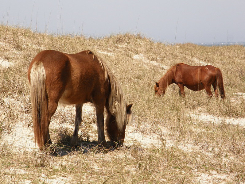
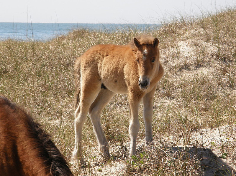
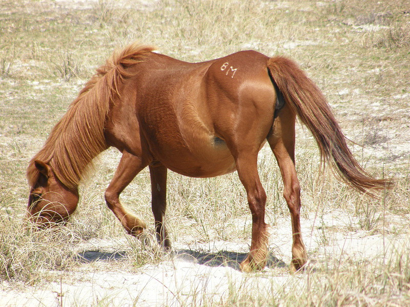
Separated from the Cape Lookout by a narrow body of water, Shackleford Banks is home to the famous wild ponies, a herd of more than 100 mustangs. Legend has it that they are descended from horses washed ashore after the wrecks of 18th century Spanish galleons. Although wild, the horses are all accounted for, numbered, named, and co-managed by the National Park Service and the Foundation for Shackleford Horses, Inc. The horses receive regular medical check-ups and are vaccinated periodically. The size of the herd is carefully regulated so that the population does not exceed what the island can support. As long as visitors maintain a safe distance and do not appear threatening, the horses usually don’t shy away when people approach. Good photos can be gotten with a telephoto lens. It’s easy to spend a morning or an afternoon traipsing among the grassy dunes in search of the ponies, though they’re often quickly and easily spotted at the western tip, near the lighthouse.
To get to the Cape Lookout National Seashore, take US 70 east from Morehead City and Beaufort. Just past the hamlet of Otway, turn right onto Harkers Island Road. Once on the island, there are several private ferries available to take you across to the southern tip of the National Seashore and/or Shackleford Banks. The seashore itself is undeveloped, so you will need to take everything that you need with you. The Visitor Center for Cape Lookout National Seashore is at the western tip of Harkers Island and is open year-round except Christmas and New Year’s Day. Hours are 9-5.
Harkers Island
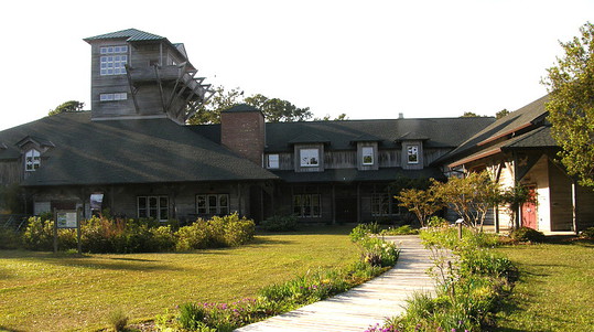
The unspoiled beaches of the Cape Lookout National Seashore, its diamond-patterned lighthouse, the wild ponies which roam Shackleford Bank, and the tranquil beauty of the Core Sound (named for the Corey Indians which once inhabited the region) are reasons enough to plan a trip to Harker’s Island. But another worthwhile attraction to this southeastern North Carolina community is the Core Sound Waterfowl Museum. The Museum is the outgrowth of the Core Sound Decoy Carvers Guild, established in 1987 by seven local artisans as a means of preserving and promoting the island’s time-honored craft of decoy carving. The Guild sponsored its first Core Sound Decoy Festival in December, 1988. The event proved so successful, Harker’s Island has played host to the festival every year since. Over time, the posters promoting the festivals – also billed as “Waterfowl Weekends” – have become collectors’ items themselves. Each year the poster showcases a different decoy and artist.

A museum was the topic of conversation among Guild members from the beginning, and in March, 1992, the Core Sound Waterfowl Museum’s first board of directors was chosen. In May of the following year, a vacated doctor’s office was transformed into the temporary home for the museum, and this small facility welcomed thousands of visitors to the island for many years. In December, 1993, the Museum board reached an agreement with the National Park Service to lease 16 acres adjacent to the Cape Lookout National Seashore Visitor Center on Shell Point, at the eastern tip of Harker’s Island, as the site of a permanent museum. Ground-breaking ceremonies on a new facility, costing $1.8 million, took place January 25, 1997. In 2002, the opening of the 20,000-square foot building portraying the state’s “Down East” traditions was the culmination of a true grassroots community project.
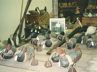
In addition to displaying its extensive collection of working and decorative decoys, the expanded facility focuses on the traditional occupations of the islanders and the inter-relationship of the Core Sound inhabitants with their envi-ronment. Exhibits reflect the seasonal activities associated with life on Harker’s Island and call attention to the region’s deserved reputation for fine boat building. Local carvers can often be found outside the Museum or in their Guild headquarters practicing their craft. Situated behind the new museum building is the Willow Pond Educational Waterfowl Viewing Area. Here, along shaded paths and observation decks, visitors can see a variety of shorebirds and waterfowl in natural wetland habitats. From Morehead City, take US 70 East about 10 miles past Beaufort. After passing through the little hamlet of Otway, turn right onto Harker’s Island Road, the island’s main thoroughfare. Hours for The Core Sound Waterfowl Museum are 10-5 Monday-Saturday, 2-5 on Sunday. The Museum is open year-round from January 2 through December 24; admission charged. A well-stocked gift shop offers a wide selection of jewelry, clothing, collectibles, art prints, and regional crafts.
Cape Carteret

Croatan National Forest is the only one of the four national forests found in North Carolina to be located along the eastern coast rather than in the western mountains. It also has the distinction of being the only true coastal forest east of the Mississippi. Croatan National Forest protects nearly 160,000 acres of pine forests, saltwater estuaries, bogs and pocosins; in particular, the pocosin ecosystems – essentially raised swamplands – are unique geological features of this forest. Bordered on the north by the Neuse River, on the south by Bogue Sound, and on the west by the White Oak River, it is not surprising that activities many activities are water-related: swimming, canoeing, boating, and fishing. 43 miles of trails offer opportunities for hiking and nature walks, however, and there are three campgrounds.
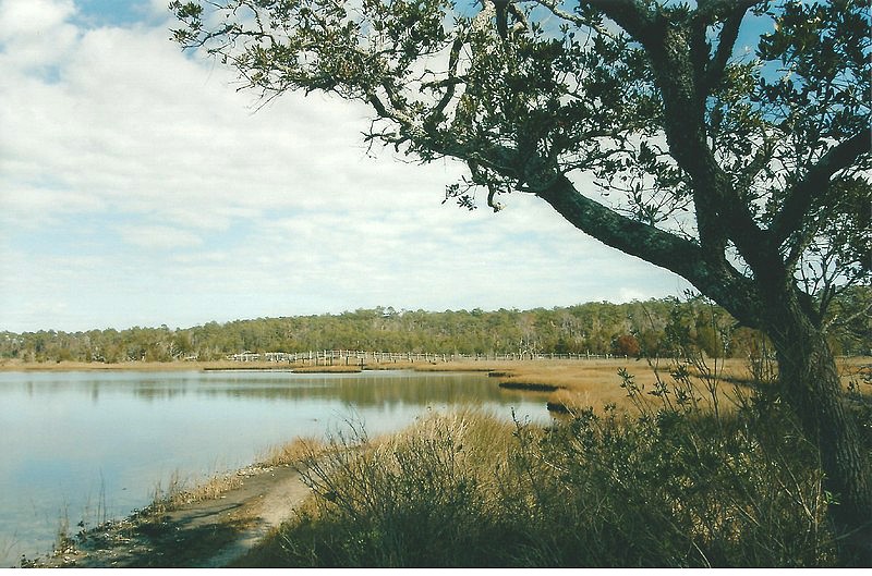
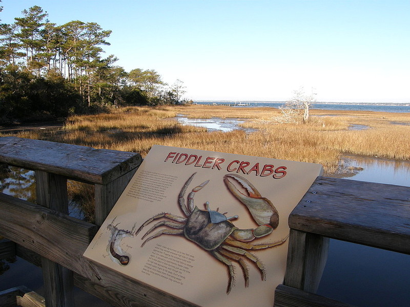
Established by Congress in July, 1936, Croatan National Forest protects stands of old growth beech and oaks, virgin longleaf pines, and cypress. There are several access points, each offering different amenities. The Neuse River Campground is situated on a bluff overlooking the river and has hot showers, flush toilets, and some electric hook-ups. Flanners Beach is located here; it’s a long, sandy beach that beckons swimmers. The 3-mile Neuse River Trail, rated easy, appeals to both hikers and mountain bike riders. The Cedar Point Campground is located in the southwestern corner of the forest and features the Tideland Trail. Designated a National Recreation Trail, it has gravel paths, raised walkways, and boardwalks. Rated easy, the trail is level, wide enough for wheelchairs, and has numerous benches for resting and viewing. Along this trail, visitors may spot egrets, deer, and herds of fiddler crabs. A .6 mile loop trail edges and crosses a salt marsh; interpretive signs along the way provide information about this vital ecosystem. A 1.3 mile loop trail connecting to this shorter loop skirts the edge of the White Oak River, crosses over the marsh, and passes through the woods.
Picnic facilities are located near the campground and a boat ramp at Cedar Point provides easy access to the Intracoastal Waterway. Neusiok is Croatan’s longest trail, running 21 miles from north to south through the eastern portion of the forest, traversing pine stands and swampland; it is a part of North Carolina’s Mountain-to-Sea Trail. Something unique to Croatan is the Saltwater Adventure Trail at Brice’s Creek. This canoe trail, suitable for novices, is the only national forest saltwater trail in the nation. Anglers, meanwhile, can test their skills along rivers, creeks, lakes, and marshes; catfish, perch, flounder, and largemouth bass are common. Although Croatan National Forest rewards visitors with many pleasant recreational opportunities, some aspects of the forest are less than welcoming. Croatan, for example, is home to some truly wild wildlife, including black bears, alligators, and eastern diamondback rattlesnakes. In warmer months, chiggers, ticks, mosquitoes, and deer flies are plentiful. Even some of the plants seem inhospitable – such carnivorous species as Venus flytrap, butterwort, pitcher plant, and sundew grow here, and visitors need to recognize and guard against patches of poison ivy. Croatan National Forest is open year round.

East of Atlantic Beach
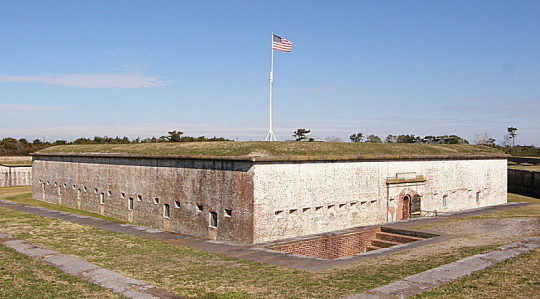
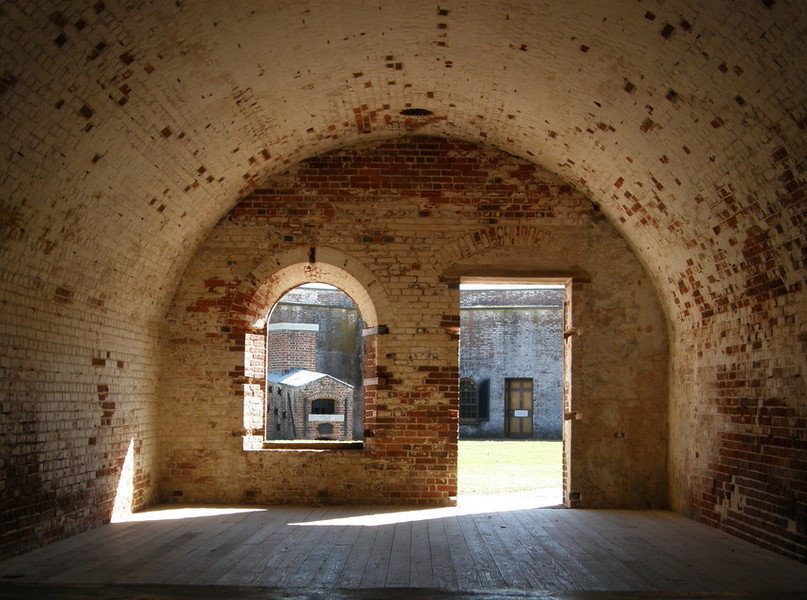
Fort Macon State Park, located at the eastern tip of Bogue Bank, is unique within North Carolina’s park system, offering visitors both the opportunity to enjoy the beauty of the state’s coastal environment and to investigate a bit of Civil War history. Nature lovers will find the the park a place of rugged beauty. A comfortable .4 mile nature trail leads through low sand dunes and dense thickets of shrubbery. The trail is named for Elliot Coues, an ornitholgist and historian who served as a physician at Fort Macon during 1869-70. Depending upon the time of year, a variety of shorebirds and migratory birds can be seen along the beach or the more secluded marshes along the northern edge of the barrier island. The park also offers fishing and swimming, with beaches both facing the Atlantic Ocean and Bogue Sound. A bathhouse and a refreshment stand are open from June 1 through Labor Day, and shelters and grills are available at two picnic areas.
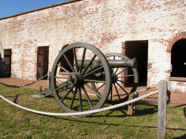
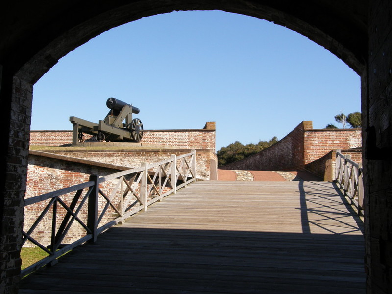
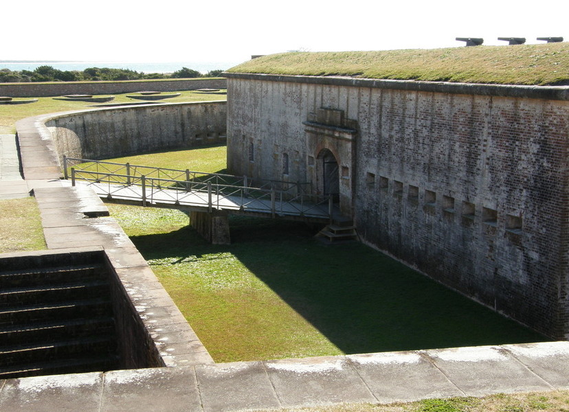
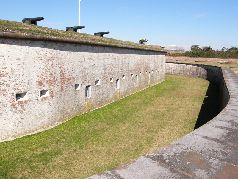
As enchanting as the locale might be, the focal point of the park is the masonry fort that gives the site its name. U. S. Senator Nathaniel Macon helped secure a $464,000 federal appropriation for its construction, which began in 1826. The installation was first garrisoned in 1834. In 1840, Robert E. Lee engineered and oversaw construction of stone jetties to help reduce erosion. Confederate forces seized Fort Macon in 1861, shortly after North Carolina seceded from the Union.

Federal forces under Major-General Ambrose Burnside recaptured the fortress April 26, 1862, the culmination of a month-long siege and an eleven hour bombardment. The inability to defend itself against large-bore, rifled artillery proved that Fort Macon and similar masonry fortifications were antiquated. Following the surrender, Fort Macon served as a coaling station for Union ships until the war’s end. Garrisoned briefly during the Spanish-American War, Congress gave the fort and surrounding land to the state in 1924. Fort Macon thus became the second park in a state system that now includes more than forty recreational areas. The Civilian Conservation Corps headed up reconstruction and restoration of the fort in 1934-35.

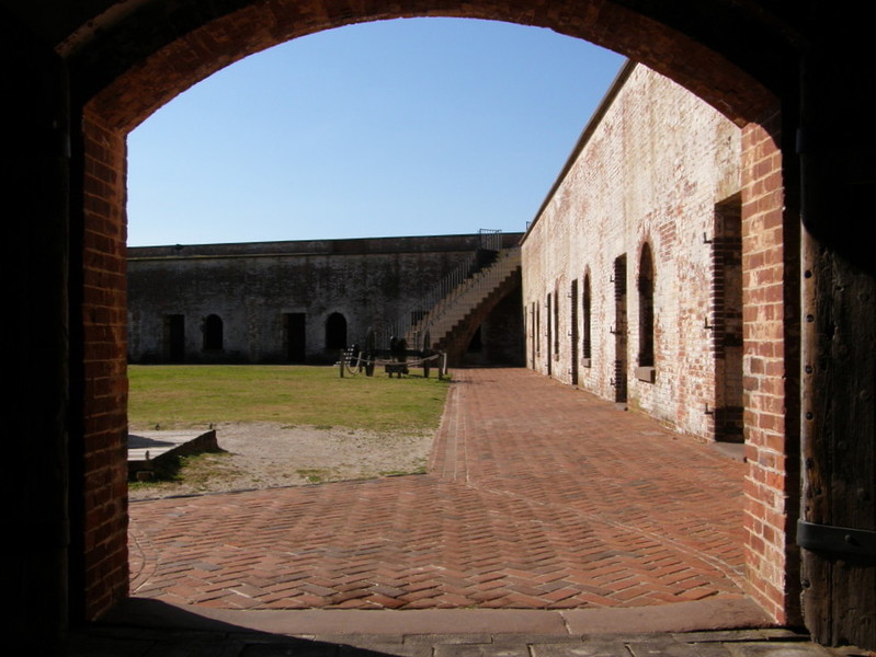
Tours of Fort Macon are self-guided. Several of the casements are enclosed and are used to display living conditions at the fort during the Civil War. Two casements to the left of the sally port as one enters the fort feature interpretive displays of the enlisted men’s living quarters and the fort commander’s quarters. A map of the five-sided fort will guide visitors from the sally port through the maze of casements, powder magazines, and storage rooms that surround the enclosed parade ground. The wide ramparts above the casements can be reached via a number of stairways, and from these elevated vantage points visitors can see Bogue Sound, Shackleford Banks, and the Atlantic Ocean. More inquisitive guests will doubtless find their way out to the dry moat that surrounds Fort Macon.
A spacious new visitor center has opened that includes numerous exhibits, a video program, and a well-stocked gift store. To get to the park from Morehead City, take the bridge that crosses Bogue Sound going to Atlantic Beach. On the other side of the bridge, turn left on State Road 1190, which ends at the park. Fort Macon State Park is open daily except Christmas. The park opens at 8:00 AM year round, but closing hours vary seasonally. 252-726-3775

Morehead City
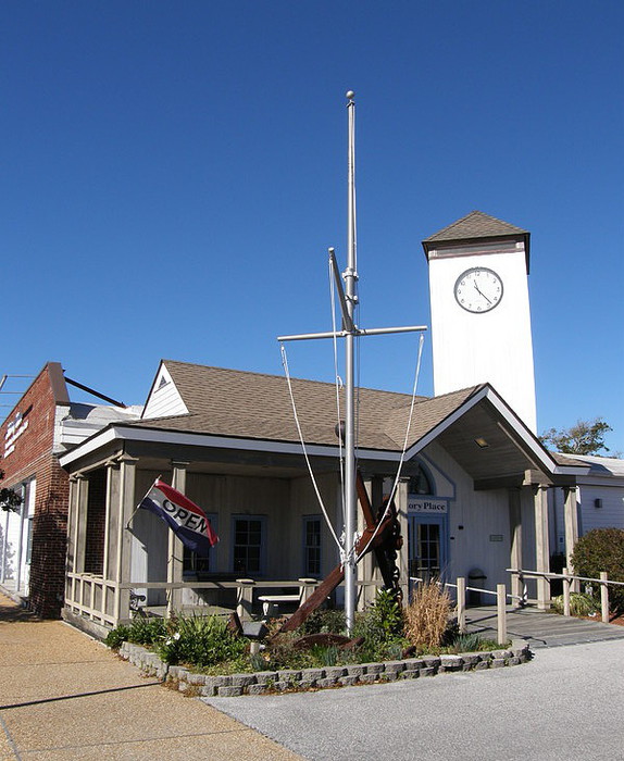
The History Place provides visitors with a look at some of the things that have shaped the lives of the people of Carteret County in a 12,000-square foot facility in the heart of downtown Morehead City. As is the case in many small regional museums, visitors often have their interests piqued by relatively minor bits and pieces from the past. The History Place has several items that fall into this category. A 1902 letter, for example, is postmarked Wit, North Carolina. You won’t find this town on a current road map, however – the small coastal town was later renamed Sea Level. The museum’s Civil War exhibit includes a single Enfield bullet, a small piece of the cargo salvaged in 1967 from the British schooner Modern Greece, sunk by Federal warships in 1862 as she attempted to run the blockade near Fort Fisher. The same display showcases a cannonball from the siege of Fort Macon, located only a few mile southeast of Morehead City at the tip of Bogue Bank. Visitors will also learn that Carteret County soldiers had something to do with North Carolina’s claim to being “First at Manassas, farthest at Gettysburg and Chickamauga, and last at Appomattox.” News of Lee’s surrender to Grant having failed to reach them, five Carteret County men fired a 24-pound brass cannon after the armistice was signed!
There’s also information about the origins of Morehead City. William Fisher, a North Carolina militiaman during the Revolutionary War and a two-term member of the N. C. legislature, made his money from shipping. He willed his daughter, Sarah, and her husband, Rev. Bridges Arendell, the land that eventually became the site for Morehead City. The area was known as Shepard’s Point as early as 1733, but when the town was incorporated in 1861 it took the name Morehead City to honor Governor John Motley Morehead. He had bought land here in 1853 to serve as the terminus for the newly incorporated North Carolina railroad. The city’s two main streets, which run parallel to the waterfront, are named Arendell and Bridges.
The museum has a small gallery intended for temporary exhibits, and fishing enthusiasts will likely find the current display to be of special interest, showcasing as it does the history of the Big Rock Blue Marlin Fishing Tournament. Big Rock is the nickname given for the spot in the Gulf Stream where boats head for the best fishing. Since 1957, an annual tournament has been held each June. The first winner received a child’s miniature red wagon filled with an unknown number of silver dollars estimated between $250 and $500 – no one remembers for sure. The prize money has gone up considerably in the years since. The History Place is at 1008 Arendell Street, the city’s main thoroughfare. Hours are 10-4 Tuesday-Saturday year round, except major holidays. Admission is free. A research and genealogy library is on the premises, and the center also houses the Tea Clipper, a small tearoom, and a gift shop with a decidedly regional slant. 252-247-7533
Pine Knoll Shores
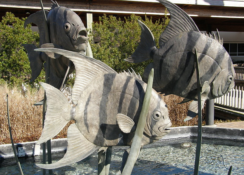
Most states are fortunate to have one aquarium to educate and entertain its residents. North Carolinians actually have three newly-renovated, greatly expanded, and much improved aquariums from which to choose. Individually, none is as grand or spacious as the Georgia Aquarium in Atlanta, the South Carolina Aquarium in Charleston, or the Tennessee Aquarium in Chattanooga. Collectively, however, the Tar Heel aquariums provide visitors with a balanced look at aquatic life across the state. The theme of the North Carolina Aquarium at Pine Knoll Shores is “From the Mountains to the Sea.” The adventure starts with a roaring indoor waterfall, and visitors gradually wind their way over the mountains, through the Piedmont, across the coastal plains, down the tidal waters, and out to the sea.
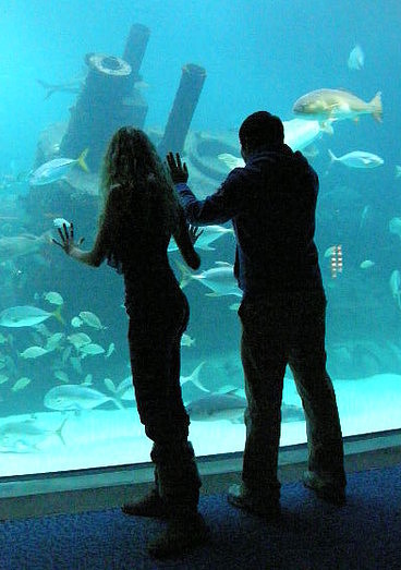
The largest exhibit tank in the state is located at Pine Knoll Shores. The 306,000 gallon tank has an acrylic viewing window 65 feet long, 10 feet high, and 8.25 inches thick. The tank is specially designed with sharks in mind, with rounded corners and a long glide path, so it is appropriate that tiger sharks, sandbar sharks, and nurse sharks are among the tank’s more prominent residents. The focal point of the tank is a ¾-scale fiberglass replica of the German U-boat U-352, sunk off the NC coast by the US Coast Guard Icarus May 9, 1942. Another exhibit tank spotlights the wreck of what is thought to be the Queen Anne’s Revenge, flagship of the infamous pirate Blackbeard. The actual wreckage lies only twelve miles from the aquarium. The aquarium also features the Marsh Boardwalk, with overlooks of Bogue Sound, a snake exhibit, and a half-mile nature trail.
Hours are 9-5 daily year-round. Closed Thanksgiving, Christmas, and New Year’s. Admission charged. Pine Knolls features a calendar of special activities, many of which include 2-to-3 hour excursions outside the building. 866-294-3477
Beaufort
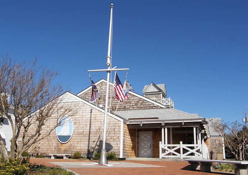
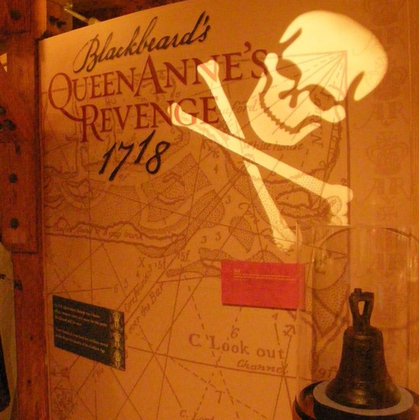
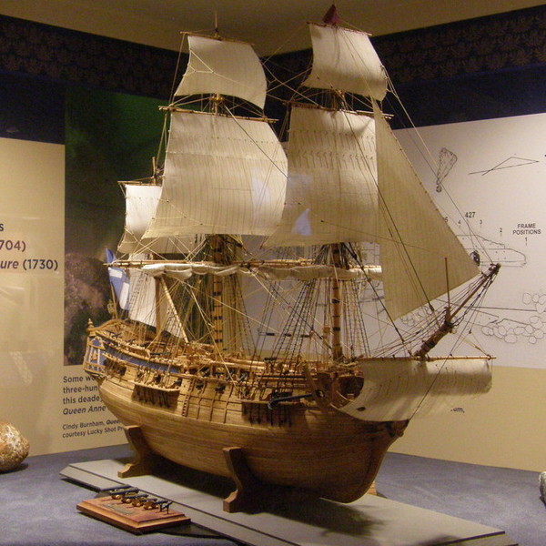
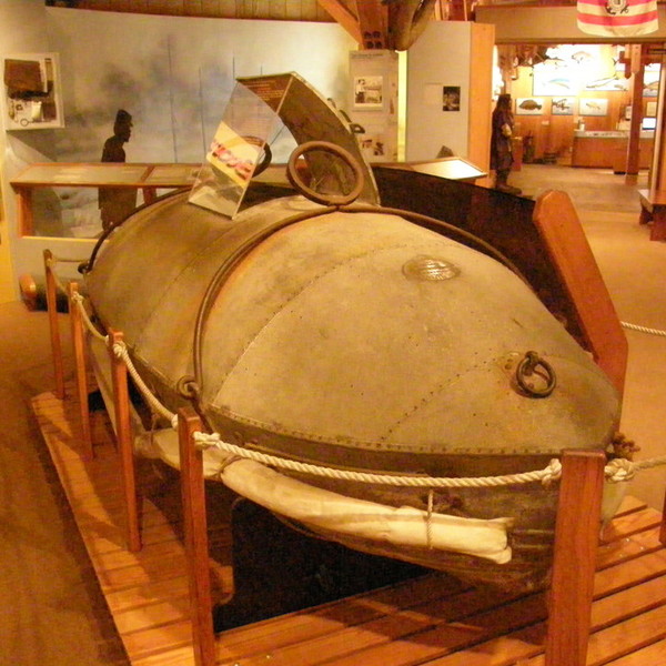
The main branch of the North Carolina Maritime Museum is ideally located in the quaint coastal town of Beaufort. The Museum, housed in a building somewhat reminiscent in appearance to the old life-saving stations that once dotted the coastline, celebrates the state’s rich maritime heritage. The exhibit hall is crowded with artifacts from North Carolina’s earliest days as the world’s leading producer of navel stores right up to present day. For many, the highlight of the Museum’s collection might be the numerous relics salvaged from what is believed to be the wreck of the Queen Anne’s Revenge, the flagship of the pirate Edward Teach, better known as Blackbeard. Displayed pieces include the ship’s bell (dated 1702), a chart compass, rigging hooks, lead weights, ballast stones, small caliber lead round shot, and even some gold dust. Three of the eight cannons recovered thus far from the site are also displayed, including a small broadside gun, a swivel gun, and a 4-pounder English cannon. The exhibit also features a detailed ¼”-to-1 foot scale model of the Queen Anne’s Revenge by Frank Gaskill.

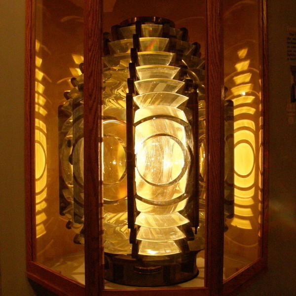
The “Soldiers of Surf and Storm” exhibit showcases the equipment used by the United States Life-Saving Service, including a breeches buoy, which was used to rescue one individual at a time, and a life car, which could hold 5-to-6 adults. The life car was the first wholly American contribution to the equipment used by the surfmen of the USLSS. Seven life-saving stations were spread along the NC coast in 1874; eventually the number grew to 29. Before becoming a part of the US Coast Guard in 1915, the USLSS was responsible for assisting 28,121 vessels and rescuing 178,471 victims. Other noteworthy artifacts include a Fresnel lens and a diving bell. Scale model boats of all sizes are displayed throughout the building.
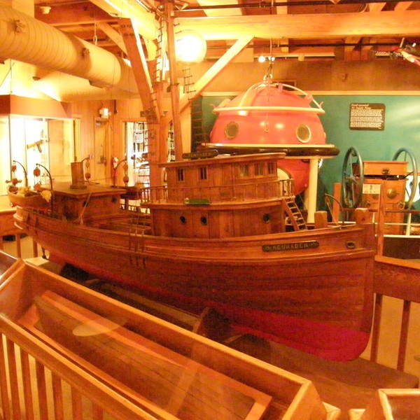
Another exhibit features working watercraft, including log boats, steamboats, skiffs, shad boats, and sharpies. Skiffs, generally 18-to-24 feet in length, enjoyed popularity for fishing and general transportation during the mid 1800s. Today they remain popular as a racing craft. George Washington Creef of Manteo is recognized as the inventor of the shad boat, which was specifically designed for easy sailing, with heavy loads, in shallow water. In 1988, the NC General Assembly added the shad boat to its list of official state symbols. Today, flat-bottomed sharpies are the most popular boat for fishing and hauling freight in the North Carolina sounds. Sharpies have the same carrying capacity as schooners at a fraction of the cost. The Museum also features exhibits on commercial fishing, whaling, waterfowling, coastal marine life, and the ecology.
Across the street from the Museum is the Harvey W. Smith Watercraft Center. The shop is active year-round and visitors can drop in to observe whatever activity might be underway at the moment. In recent years, a full-sized replica of a World War II-era landing craft, 36 feet long and 10-½ feet wide, was constructed at this facility. The center offers a variety of classes each year, from the basics of traditional and contemporary boatbuilding carpentry to more specific skills such as sail making, the proper use of knots and splices, and oar making. Actual boat building classes are also offered. Hours are 9-5 Monday-Friday, 10-5 Saturday, and 1-5 Sunday. Closed Thanksgiving, Christmas, and New Year’s Day. Admission is free. 252-728-2124
Beaufort
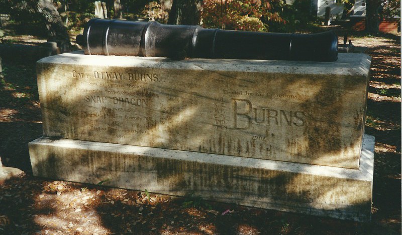
A walking map and guide of the "Old Burying Ground" can be obtained at the Beaufort visitor center for a nominal fee and will make a visit to the grounds far more rewarding. There are fascinating stories to learn about individuals interred here, such as the unknown British naval officer who was buried standing up in full uniform, or the girl who died en route from England to America and whose body was preserved in a barrel of rum so it could be returned to Beaufort for burial. Townspeople such as Samuel Leffers and Josiah Bell, who owned two of the homes now open for public tours, are also buried here. The most famous individual interred in the Old Burying Ground is Otway Burns, whose exploits as a privateer during the War of 1812 won him national acclaim.
Portsmouth Island
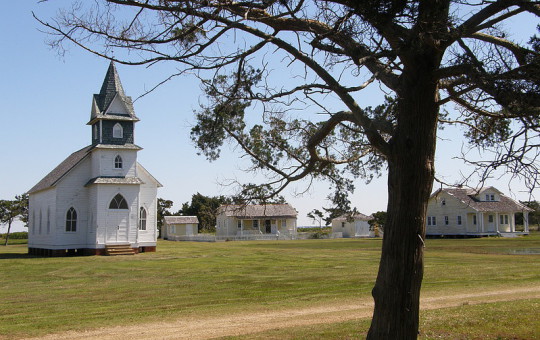
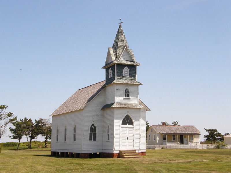
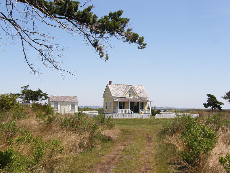
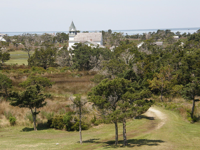
Portsmouth Village is a deserted town on the northeastern tip of Portsmouth Island, part of the Cape Lookout National Seashore. With the Atlantic Ocean to the east and Pamlico Sound to the west, it’s a genuine “coast-sound ghost town.” It’s also among the more challenging places to get to in North Carolina. The North Carolina Ferry System will transport you from Cedar Island, Swan Quarter, or Hatteras Island to Ocracoke Island. From the quaint barrier island village of Ocracoke, a private ferry takes you to Portsmouth Island and the village that bears its name.
The town of Portsmouth was established in 1753 by an act of the North Carolina general assembly. Within twenty years, it had become the largest settlement on the Outer Banks. At that time, Ocracoke Inlet was the principal trade route through the barrier islands, but the inlet was too shallow to allow heavily laden ships to pass. Cargo had to be off-loaded onto shallow draft boats, and Portsmouth offered warehousing and support facilities for this “lightering” trade. By the 1840s, two-thirds of the state’s exports passed through Ocracoke Inlet. In 1846, however, a storm opened a new, deeper inlet at Hatteras, while the inlet at Ocracoke was beginning to shoal. Portsmouth soon lost its niche as a center of commerce. The town suffered another setback during the Civil War, when many residents left the island, never to return. Fishing became the primary livelihood for those who remained. In 1894, new life was pumped into the community when a U. S. Life Saving Station was established at Portsmouth, and for nearly fifty years the station helped the town to survive. After the station closed in 1937, the community struggled with economic depression, isolation, and the chronic threat to life and property from storms. By the mid-1950s, Portsmouth’s population was only 17, and the only item that could be purchased in town was a stamp. The post office, first opened in 1840, closed in 1959. The last two residents headed for the mainland in 1971, making Portsmouth the kind of “ghost town” that, were it not for the Atlantic Ocean on the horizon, one would associate with a western movie.
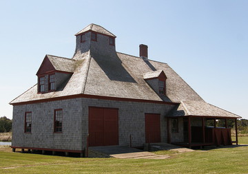
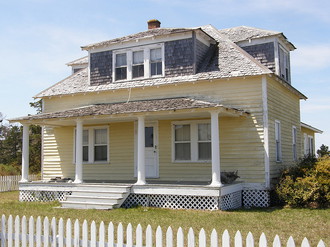
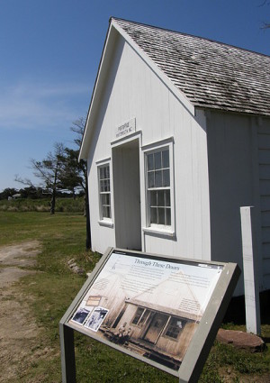
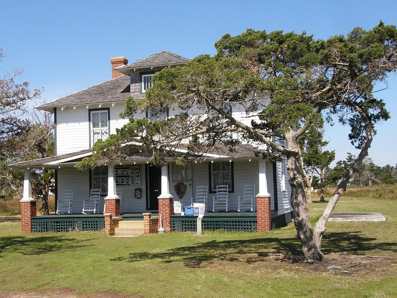
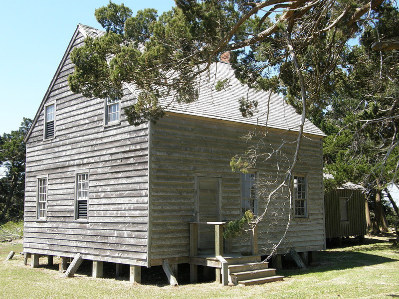
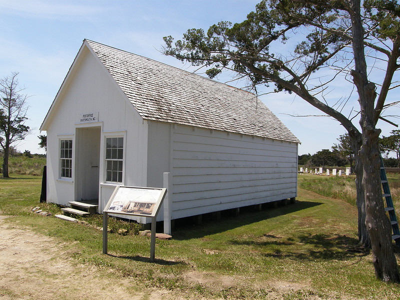
In 1976, the Cape Lookout National Seashore was established, and Ports-mouth’s 250-acre historic district landed on the National Register of Historic Places. Today, sightseers can learn about the town’s history and its former inhabitants from exhibits on display in the Dixon/Salter house, which serves as the visitor center. Other buildings open to the public are the post office/general store, the Methodist church, the schoolhouse, and the U. S. Life Saving Station. Those willing to climb the two steep ladders leading from the station’s second floor to the observation tower will be rewarded with a breathtaking 360-degree view of the village, sound, island, and ocean. Although closed to the public, there are more than a dozen weathered, bungalow-style frame houses that can be viewed while walking the village lanes, and several small cemeteries dot the settlement.
A little over a mile past the Life Saving Station is the Atlantic Ocean, and a well-marked path leads from the village to the beach. The northeastern tip of Portsmouth Island is lightly trafficked, so it is an ideal spot for beachcombers looking for shells. It’s also a good spot for bird watching and kite flying. While on the ferry between Ocracoke and Portsmouth you’ll see the location of Confederate Fort Ocracoke and Teach’s Hole, the latter a favorite harbor for the pirate Blackbeard and the place where, in 1718, the infamous rogue met his fate. A private ferry operated by Rudy Austin, a third generation Ocracoker, takes passengers on a half-hour boat trip to Portsmouth Island. In season, the trips are scheduled to leave daily at 9:30 AM, with a pick up scheduled for 2:00 PM. Call ahead for reservations and cost. 252-928-4361. On Portsmouth Island, a visitor center occupies one of the island’s original buildings, and flush toilets are available here. Otherwise, conditions are primitive, and there is no running water. The mosquito population makes this a poor choice for a picnic. Bring insect repellent, sun block, drinking water, hand wipes, and a brimmed hat.
Carteret County is bordered by CRAVEN, JONES, and ONSLOW counties.
Return to REGION THREE HOME PAGE.
Return to GEOGRAPHIC REGIONS HOME PAGE.