MITCHELL COUNTY
Scroll down this page or click on specific site name to view features on the following Mitchell County attractions/points of interest:
Museum of North Carolina Minerals, North Carolina Mining Museum, Roan Mountain

Fast facts about Mitchell County:
Created in 1861, the county is named for Elisha Mitchell, a professor at the University of North Carolina who correctly determined that Mount Mitchell was the highest peak in the state.
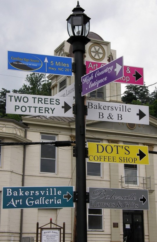
The county seat is Bakersville, named for David Baker, an early settler to the area. Other communities include Bandana, Penland, Poplar, Red Hill, and Spruce Pine.
Mitchell County’s land area is 221.43 square miles; the population in the 2010 census was 15,579.
It is worth noting that the Penland School of Crafts, one of the oldest handicraft schools in the nation, is located in Mitchell County.
Spruce Pine
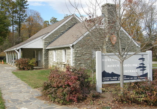
The Museum of North Carolina Minerals is located at Milepost 331 on the Blue Ridge Parkway, at the junction with NC highway 226. The surrounding mountains are rich with gems and minerals, and the Museum displays more than 300 varieties, along with interactive displays about them and information detailing the economic importance of the mining industry to the region. The building also includes a visitor center for the Mitchell County Chamber of Commerce, making it a good source for information about area attractions, restaurants, and lodging. Hours are 9-5 daily. Admission is free. 828-765-2761
Little Switzerland
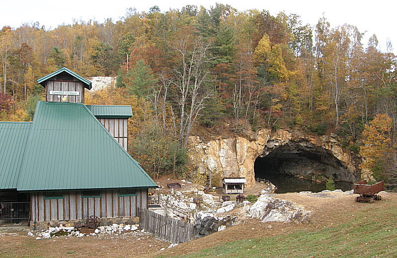
The North Carolina Mining Museum, part of Emerald Village in Little Switzerland, gives visitors an opportunity to take a self-guided, 30-to-45 minute underground tour of the historic Bon Ami Mine. Opened in 1924, the mine provided feldspar used in making the well-known household product Bon Ami Scouring Cleanser – a useful item still available in the site’s gift shop. A souvenir booklet serves as a guidebook to the site. Inside the mine, visitors will see displays of mining tools, the railroad tracks and equipment used to transport the ore, and veins of smoky quartz and glittery mica. The Black Light tunnel uses ultraviolet lamps to let visitors see the mine in a different light. Hours are 9-5 daily from April 1 through October 31; closing hours extended to 6 PM from Memorial Day through Labor Day. Admission charged. 828-765-6463
North of Bakersville
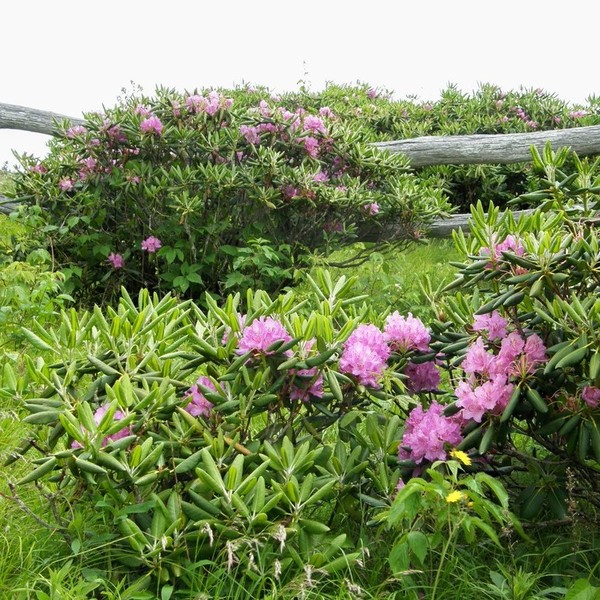
Exactly how Roan Mountain got its name is a little unclear. Some think it was the reddish appearance of the rhododendron blooms that proliferate in June that gave the Roan its name. Others speculate it came from the mountain ash berries that cover the ground in September. A more fanciful story is that the name came from Daniel Boone’s having left a roan horse to graze here while he traveled farther west. The mystery surrounding the name notwithstanding, it’s no mystery at all as to why Roan Mountain is a favorite destination point for travelers, especially in summer. Dr. Elisha Mitchell, for whom Mt. Mitchell and Mitchell County are named, once called Roan Mountain “the most beautiful of all the high mountains. The top . . . may be described as a vast meadow without a tree to obstruct this prospect, where a person may gallop his horse for a mile or two with Carolina at his feet on one side and Tennessee on the other, and a green ocean of mountains rising in tremendous billows immediately around him.” Although this picturesque description was given nearly 175 years ago, it still holds true. See for yourself!
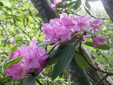
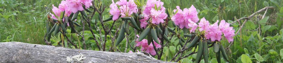
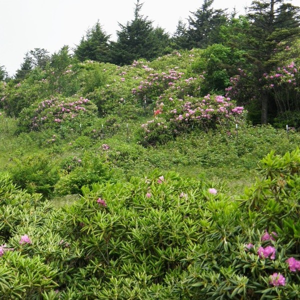
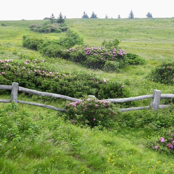
Roan Mountain is not actually one mountain, but rather a high ridge running about five miles in length along the North Carolina-Tennessee border. The low point, at 5,500 feet, is Carver’s Gap; the high point, 6,285 feet above sea level, is Roan High Knob. According to a marker along the mountain crest, the first rays of the morning sun to fall on North Carolina soil fall here, rather than on the state’s easternmost shore, some 350 miles distant. While this distinction is probably lost on the average visitor, the next point of distinction is most assuredly is not. Roan Mountain is home to the largest natural Catawba Rhododendron gardens in the world – more than 600 acres of rhododendron thickets are in full bloom from mid-to-late June, attracting thousands of visitors.
The natural gardens are dense thickets of rhododendron bushes, many taller than six feet. Nature has a way of pruning the bushes, by wind and harsh winter weather, into nicely rounded, manicured shapes. From mid-to-late June, the peak blooming period, the gardens showcase thousands of magenta blooms. Parking, rest rooms, and picnic tables are located near the short trail to the gardens; the easy, paved trail itself is handicap-accessible. The Cloudland Trail is a moderate 1.2 mile hike, which leads from the site of the former Cloudland Hotel, a popular retreat which operated from 1885 to 1910, to the Roan High Bluff Overlook. From here, if weather cooperates, visitors can look west into seven states. The more adventurous might want to walk along a stretch of the famous Appalachian Trail. Photo opportunities present themselves almost everywhere you turn.
To get to Roan Mountain from Bakersville, take NC 261 North. There is a free parking area at the base of the mountain at Carver’s Gap, just before crossing the state line into Tennessee. The two-mile road from Carver’s Gap to the Rhododendron Gardens at the top is open April to November. There is a small fee per vehicle to park at the summit.
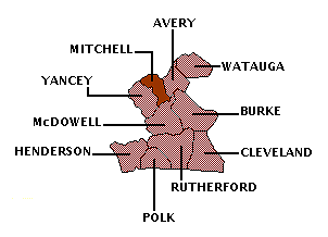
Mitchell County is bordered by AVERY, McDOWELL, and YANCEY counties.
Return to REGION NINE HOME PAGE.
Return to GEOGRAPHIC REGIONS HOME PAGE.